Quick blog this evening to give you the details on what to expect tomorrow as the first fairly wet and stormy day in a very long time intersects with Halloween and trick-or-treating!
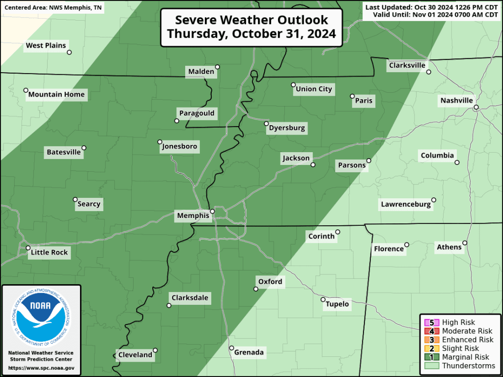
A cold front will move into the region Thursday and then stall out over the Mid-South for a couple of days. With plenty of moisture (high dewpoints) in place and fairly strong wind flow ahead of the system and above us, some thunderstorms are expected, in addition to several hours of rain. In fact, we are also in a severe weather risk for the first time in what seems like months, though it is a low-probability Level 1 (Marginal Risk). IF there were to be severe weather (outside of thunder and lightning), it would be a few strong wind gusts in the main batch of storms.
As far as timing, that main area of rain and storms ahead of the front will slowly push into the metro from Arkansas after 9-10am and continue pushing east through early afternoon. Most of those hours will be wet with an inch of rain possible. By mid-afternoon, that main rain band looks to push east of the metro with rain chances dropping quite a bit for a few hours. During the evening hours, scattered showers start popping back up and continue into the night as the front stalls over the region.
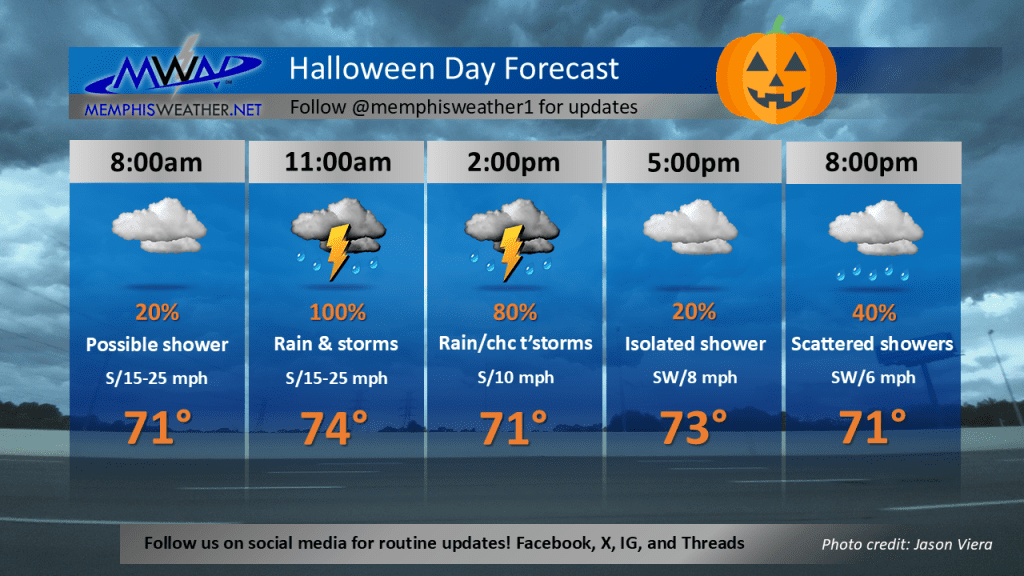
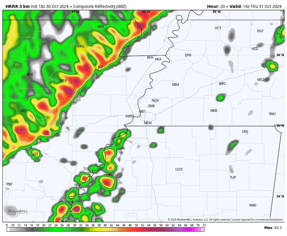
That leaves a potential for mostly dry weather between about 3pm and 8pm. If you plan to trick-or-treat, aim for early evening and have your umbrella or rain jackets handy! Below is a loop from the HRRR model that shows how it believes the system will evolve Thursday, starting at 9am and ending at 9pm.
Erik Proseus
MWN Meteorologist
—
Follow MWN on Facebook, Twitter/X, BlueSky, Threads and Instagram for the routine updates every day!
Visit MemphisWeather.net for the latest weather information and our MWN Forecast for Memphis and the Mid-South
Looking for a way to support us? Click here for one-time or recurring options! Thank you!