

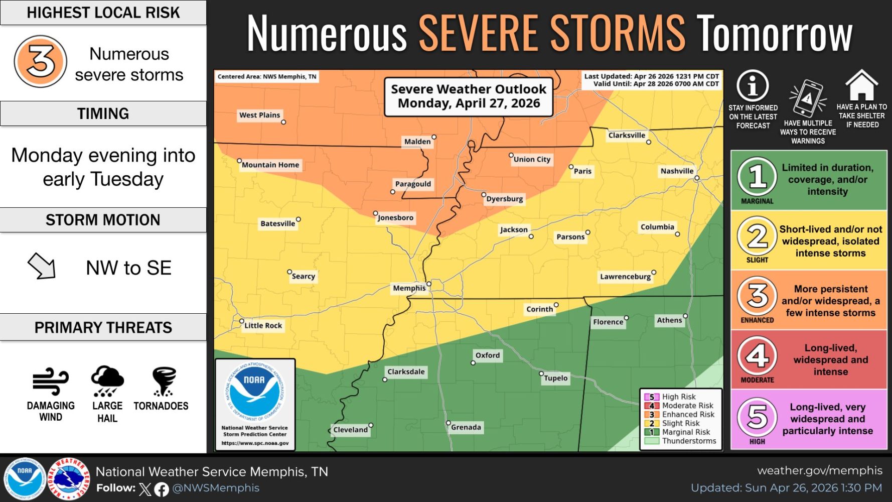
An active severe weather pattern across the middle portion of the country will result in two potential severe weather threats in the coming 72 hours, especially in the mid-Mississippi Valley to Mid-South and Tennessee Valley.
Monday evening/night
The first round has been well-advertised and has been adjusted daily since it was first identified several days ago. Monday has been a day to keep an eye on. As we zero in on the details, we’re now fairly confident that most if not all of the daytime Monday will be dry, windy and very warm as significant severe weather affects the Midwest. By late afternoon, as a cold front drops south, thunderstorms will likely build on it across southern MO and into AR and sweep towards the Mississippi River from northwest to southeast.
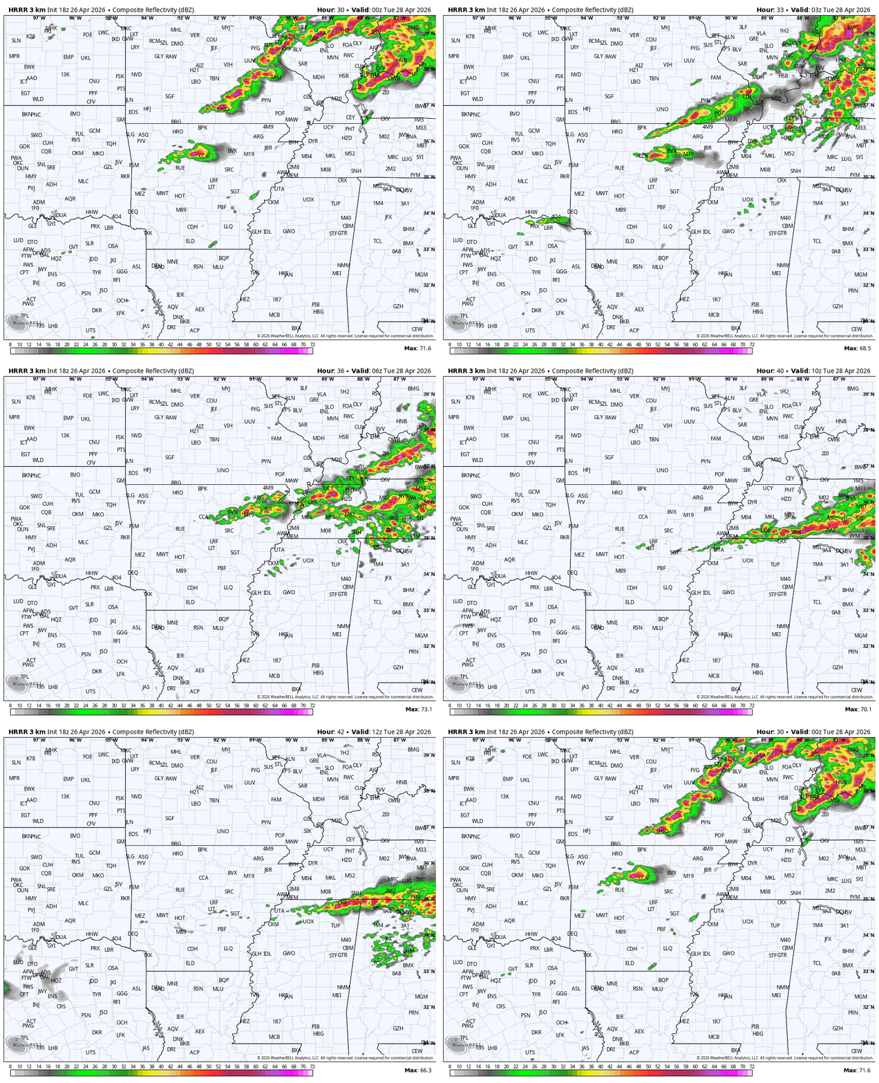
Current projections from high-resolution models that now have this event in focus indicate that Memphis could be near the (southern) tail end of the developing line and not until after dark, perhaps after midnight. As the line orients almost west to east across the area ahead of a stalling front, storms may affect parts of the metro for a few hours in the pre-dawn period on Tuesday morning. This could result in some places getting a good amount of much-needed rainfall, while some areas aren’t so lucky.
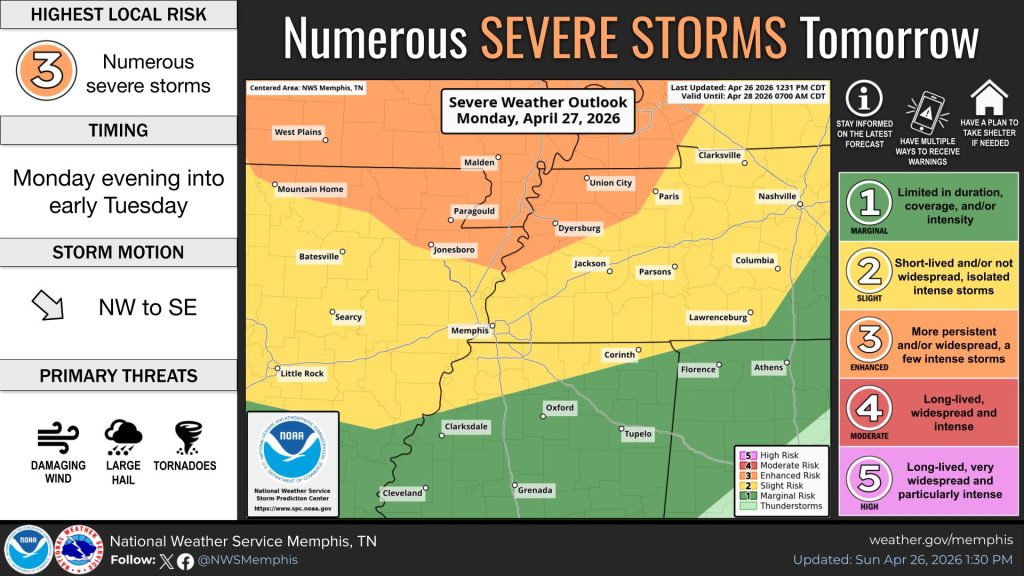
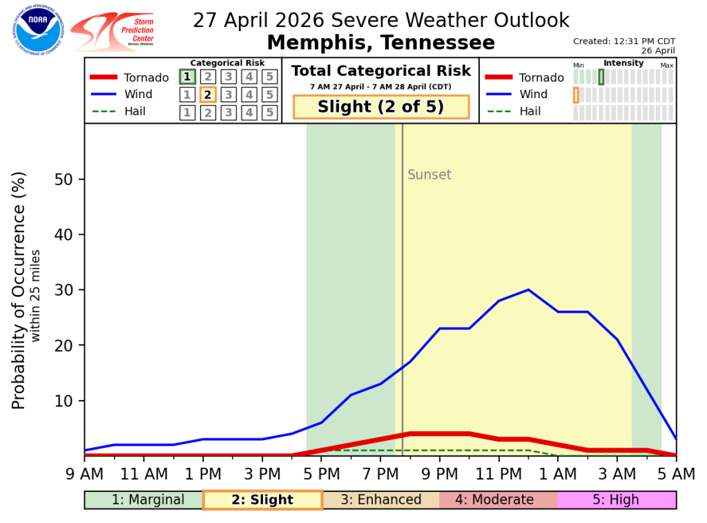
As for severe weather threats, strong to damaging wind will be the main hazard. There is also a low-end threat of a tornado and some hail can’t be ruled out. Areas north of the metro are highlighted for the potential for a strong tornado, though that is conditional on one actually forming, which is low probability. The severe weather risk level is currently 2/5 (Slight Risk) for the entire metro, though a level 3 exists north of Covington.
Tuesday evening/night
Once early morning showers and storms weaken around sunrise, the atmosphere will recharge Tuesday ahead of the stalled front sitting to our north. A low pressure area and potent upper level disturbance will trigger additional scattered thunderstorms to our west on Tuesday. These will move east into the Mid-South late Tuesday afternoon into the evening as the cold front makes its approach.
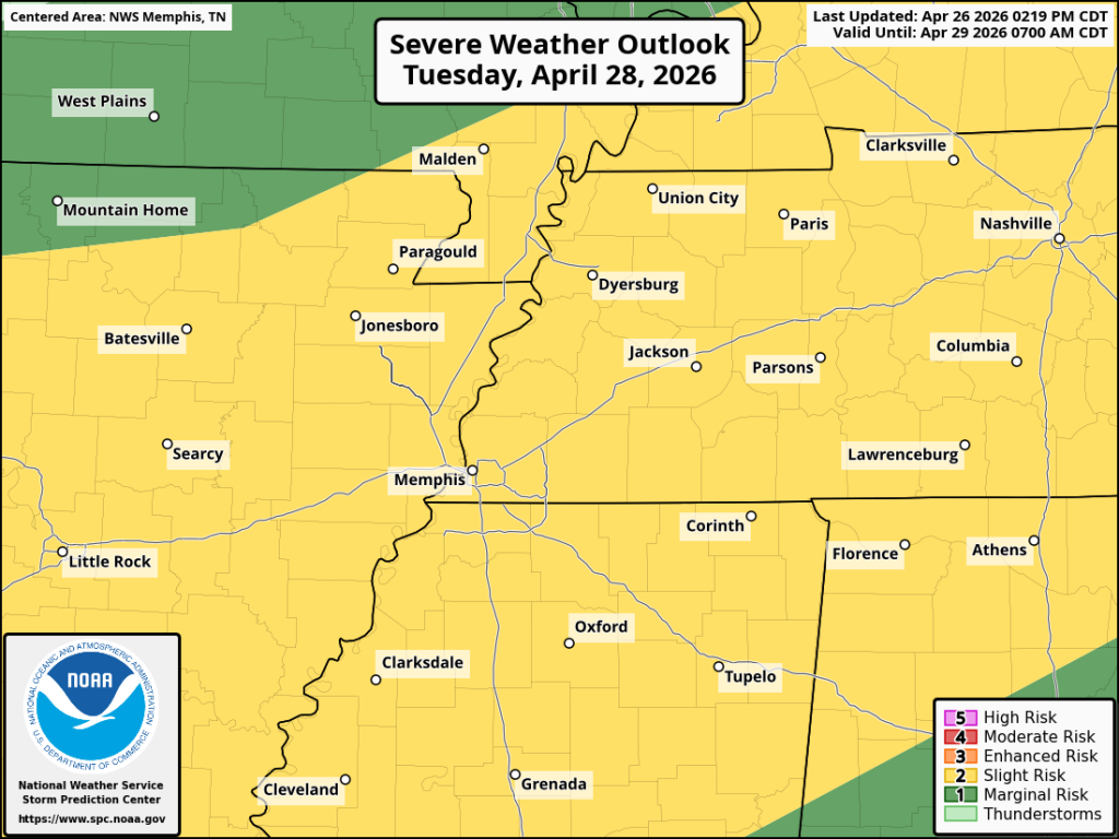
Once again, strong to severe thunderstorms will be possible across the metro with the primary hazards appearing to be damaging straight line wind and large hail, while the tornado threat is fairly low probability once again. Heavy rain is once again expected in any storms that form as well. Like on Monday night, the overall risk level is a 2/5 (Slight Risk).
Prepare now
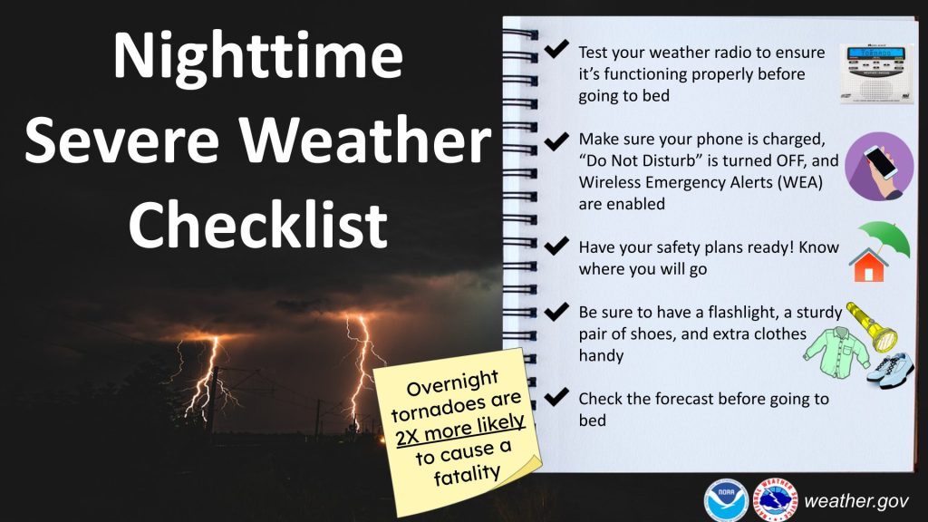
Overnight severe weather threats are not rare in the Mid-South, but it’s time to polish off the severe weather prep for times when you might be sleeping. Obviously being prepared to act quickly is important if you aren’t consistently monitoring the weather. Have your batteries charged (including cell phones) and safe place ready to go before you retire for the night on Monday night. Make sure everyone in the house is aware of the safety plan and is ready to act quickly if needed.
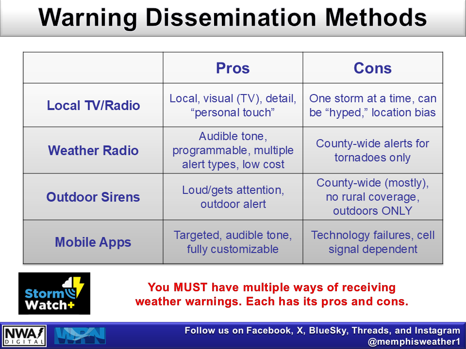
Always have multiple ways of receiving severe weather alerts, particularly overnight. Outdoor warning sirens should NOT be relied on anytime, but especially at night when you can sleep through the siren or not hear it due to heavy rain or wind. A NOAA Weather Radio is a great option as it will wake you up for severe weather.
Also cell phone alerts are another good method if properly used. Wireless Emergency Alerts, built into most modern cell phones, will alert you to Tornado Warnings IF you have not disabled them and IF your phone is not on silent. In addition, our in-house severe weather alert app, StormWatch+, will wake you up for Tornado and Severe Thunderstorm Warnings, including overriding silent/Do Not Disturb settings, and alert you for a multitude of other alerts that you may choose from. An inexpensive subscription is required but can alert you to up to 5 locations across the country along with many other great features. Bottom line: make sure your phones are charged and not on silent for overnight threats.
Cooler weather follows the storms
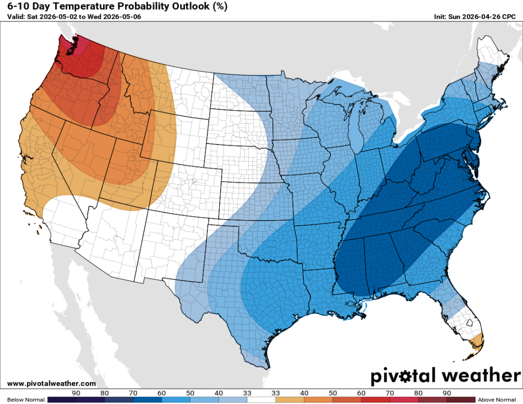
Once precipitation departs Wednesday morning with the front pushing south of us, it appears drier weather sets in for at least a few days, if not longer. In addition, a much cooler pattern arrives, bringing back those beautiful conditions that seemed to be fleeting this spring. The only fly in the ointment that may slightly tarnish the weekend and RiverBeat Music Festival down on the river is low pressure moving along the Gulf coast, which could throw some light rain up and over the Mid-South. There is still a lot of time for that to change though, so for now we’ll look forward to calmer and overall cooler conditions!
Erik Proseus
MWN Meteorologist
—
Follow MWN on Facebook, Twitter/X, BlueSky, Threads and Instagram for the routine updates every day!
Visit MemphisWeather.net for the latest weather information and our MWN Forecast for Memphis and the Mid-South
Looking for a way to support us? Click here for one-time or recurring options! Thank you!







Thank you Skywarn spotter here in Wildersville Tennessee
Thank you for your service with Skywarn! Be safe!