

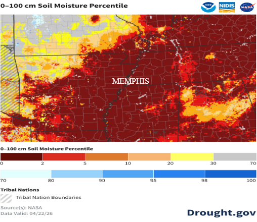
Spring so far this year has been warm and dry, especially during the month of April. For reference, Memphis has recorded just 0.81” of rainfall this month, well behind the April average of 5.50”. The lack of rainfall is evident not only in the ongoing drought but also in soil moisture conditions. These conditions can be observed in daily maps that show how dry the surface is compared to historical averages. Current data shows 0–2% percentile values across the metro, meaning soils are extremely dry compared to historical averages. Furthermore, the metro is in severe drought conditions per the USDA. Yard watering season started early this year!
With about a week left in April, the pattern is set to shift. Spring will flip sides, bringing much-needed rainfall to the region. While totals will vary by location, widespread 2–4 inch rain totals are expected over the next 7 days.
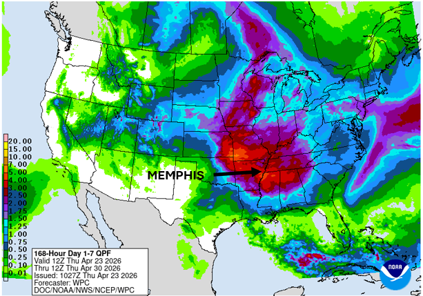
The Mid-South will see multiple rounds of heavy rain, thunderstorms, and possible severe weather over the next week. Here’s a breakdown.
Friday
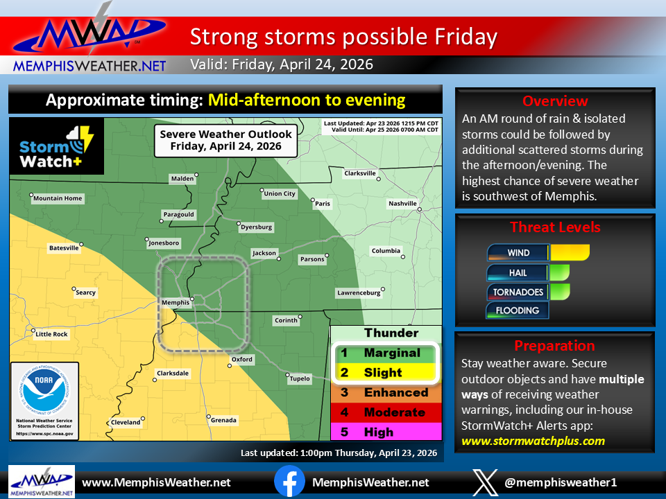
Friday begins the stretch of rainy, stormy weather, with some storms possibly strong. An upper-level trough will move eastward from the west coast and will bring an intensifying low pressure over the Plains and Midwest. Storms are expected to develop to our northwest and move into Missouri and Arkansas into early Friday. By the time they reach the metro mid-morning, they will be weakening.
However, redevelopment of showers and thunderstorms is possible in the afternoon to evening hours, though most activity should remain below severe limits. The main threat is gusty wind with a minor hail risk. Most of the metro is under a Marginal Risk (Level 1/5) for severe weather. High temperatures will be near 80 degrees,
Saturday/Sunday
Saturday looks to be a mainly dry day, with some sunshine and highs in the low 80s. Persistent southerly wind will shift to the northeast behind Friday’s system, but dewpoints (humidity) won’t drop much if at all.
Sunday likely starts off with sunshine; however, a slight chance of showers does exist in the evening and overnight hours. There has been a trend in the models towards perhaps more rain than forecast now, so keep an eye out for increasing rain chances. Severe weather is likely to remain well to out west. Highs will be in the low 80s, and lows will stay near the mid-60s through the weekend.
Monday – severe weather threat
Monday remains a day of significant interest across our region. The Storm Prediction Center currently highlights a Day 5 outlook with a 30% risk of severe storms (equivalent to a Level 3/5 risk are) just north of the metro, while a broader 15% risk (Level 2/5 equivalent) includes all of the greater metro.
A surface low will rapidly intensify and move across the Central Plains into the Upper Midwest. The track of the low pressure puts the Memphis area in favorable position for possible severe weather. Sufficient moisture and storm fuel (CAPE) will be overlapped with strong upper-level wind to create a potential for severe weather.
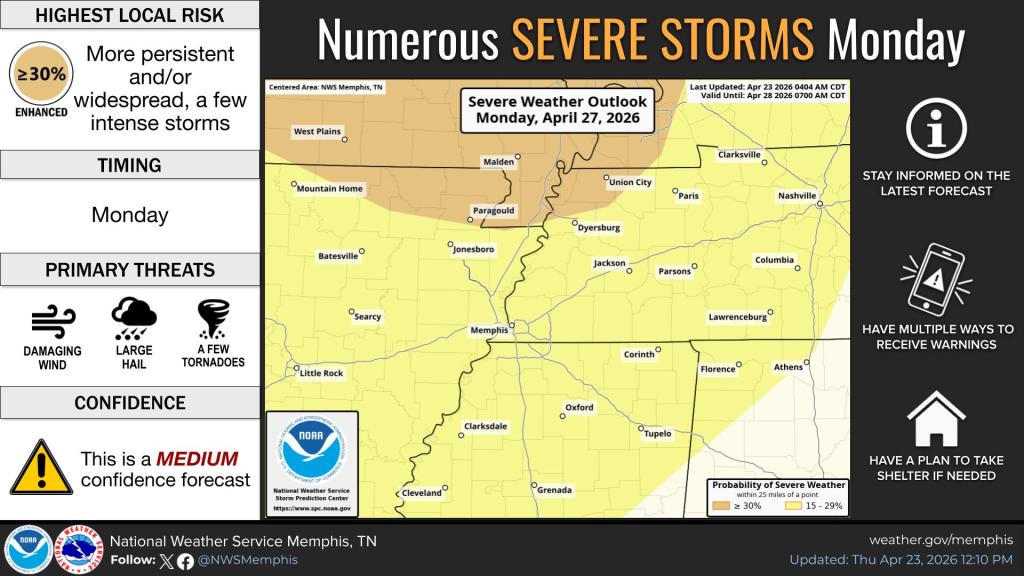
Details on impacts and timing (other than most likely the latter half of the day) cannot be completely ironed out at this time, but Monday needs to be watched for severe weather potential. Primary threats are likely to include damaging winds and large hail, while ingredients for tornadoes are present in some model data.
Tuesday-Thursday
Behind Monday’s potential severe weather event, the mid-week period looks to continue to be unsettled ahead of one more front that should dry us out and cool temperatures down heading into the first weekend in May. Additional rainfall can be expected at times in the Tuesday-Wednesday timeframe, and perhaps even a few strong storms, but ensemble model data suggests that the focus for strong storms may push just to our south.
On Thursday, the final cold front approaches and brings the risk of thunderstorms and possibly heavy rain. With any luck, it will be gone by Friday morning, in time for the opening of RiverBeat Music Festival in Tom Lee Park and “setting the stage” for a beautiful spring weekend!
Aidan O’Brien, Meteorologist Intern
Erik Proseus, MWN Meteorologist
—
Follow MWN on Facebook, Twitter/X, BlueSky, Threads and Instagram for the routine updates every day!
Visit MemphisWeather.net for the latest weather information and our MWN Forecast for Memphis and the Mid-South
Looking for a way to support us? Click here for one-time or recurring options! Thank you!







