


On the heels of the largest one-day snowstorm in 40 years in Memphis, an intrusion of polar air is headed for the central and eastern United States. The Mid-South will bear the brunt of it over the MLK Day holiday, lasting through at least the middle of next week.
However, unlike last week’s snow-pocalypse, next week’s airmass will be much colder and likely also drier.
Warmer weather teases before temperatures crash
Heading into the holiday weekend, shivering Southerners will appreciate a warm-up that results in daytime temperatures well into the 50s. Morning lows will generally be at or just above freezing, which will mean the last of the snow lingering in shaded areas should melt in the coming days.
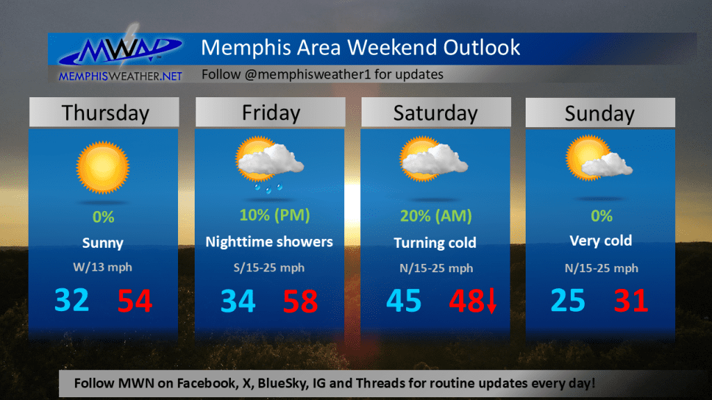
The cold front that brings a drop in temperatures ahead of the bitterly cold airmass next week arrives early Saturday. It will be preceded by widespread, mainly overnight, rain showers that will hopefully wash the salt and dirt off the roads after last week’s storm.
Most rain will be gone as we wake up to the mid 40s Saturday morning. However, temperatures will likely fall during the day as gusty north wind escorts the cold air originating in Canada. By Sunday morning, wind chills will be in the teens with temperatures in the mid 20s. And despite sunshine, they won’t improve much during the day, topping out near freezing with the gusty north wind continuing to blow.
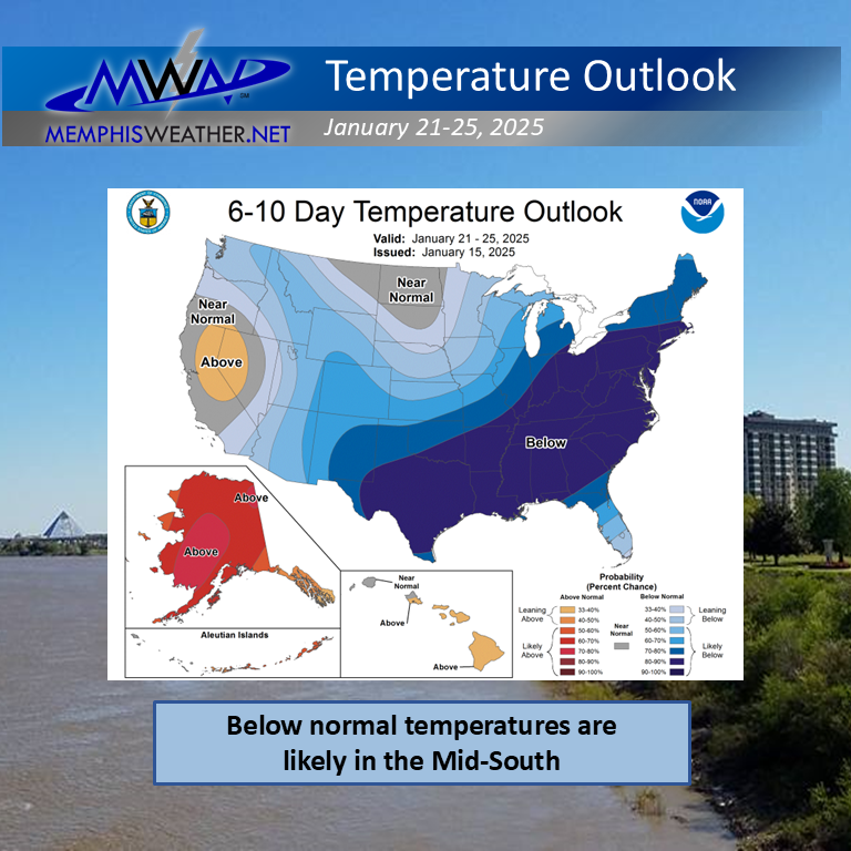
Early next week, the Arctic airmass moves overhead, making for a bitterly cold holiday Monday with lows in the mid teens and highs in the mid 20s. Similar conditions are expected Tuesday with a slight warming trend from mid-week into the end of the week. That would result in temperatures about 20-25 degrees below normal during what is historically the coldest time of year in Memphis.
Arctic air, but snow?
Despite the overwhelming evidence of cold air, there is much less certainty about precipitation chances. Early forecast data, admittedly a week out and still low confidence, suggests the potential for another “southern stream” storm system towards the middle of the week. However, there is a chance that the southern track may be further south than last week due to the depth of the cold air in place. That could take any storm system south of the Memphis area.
At a minimum, Mid-Southerners should prepare for the coldest air of the season next week and monitor later forecasts on the potential for any winter shenanigans.
Erik Proseus
MWN Meteorologist
—
Follow MWN on Facebook, Twitter/X, BlueSky, Threads and Instagram for the routine updates every day!
Visit MemphisWeather.net for the latest weather information and our MWN Forecast for Memphis and the Mid-South
Looking for a way to support us? Click here for one-time or recurring options! Thank you!







