

While it won’t rival the seven-inch snow that fell a little over a month ago, another round of winter weather is headed for the Mid-South Tuesday night. The winter storm will quickly be followed by an Arctic blast that will keep temperatures below freezing for the rest of the week. Get ready to drip the faucets!
Weather whiplash
We’re just a couple of days removed from a spring-like severe thunderstorm event on Saturday that resulted in Tornado Warnings in the Memphis metro and a handful of tornado touchdowns in the Mid-South. But a few cooler-than-average days since then have set the stage for a completely different weather event: another winter storm.
As low pressure moves along the Gulf Coast on Tuesday night, it will spread moisture north into the cold air that is being reinforced by a building Arctic airmass over the center of the country. Precipitation starts falling late Tuesday afternoon to early evening. Depending on exact temperatures at onset, it could be cold rain in the city, but will likely go through phase changes, including the potential for some sleet, before transitioning to snow before midnight.
Areas north of Memphis will start a bit colder and will likely just see snow while north Mississippi has a better chance of seeing a lengthy period of mixed precipitation, possibly including some freezing rain. Snow will continue overnight in the greater metropolitan area, ending by mid-morning Wednesday at the latest.

Expected snow and ice totals
The combination of cold air and available moisture will result in highest snowfall totals north of Memphis, with up to 3 to 5 inches of snow across northeast Arkansas and northwest Tennessee. Snow totals will taper off from north to south, with one to two inches the most likely scenario in Shelby County. South of the state line, northern Mississippi will probably see an inch or less of the white stuff, but will also see a coating of sleet and freezing rain.
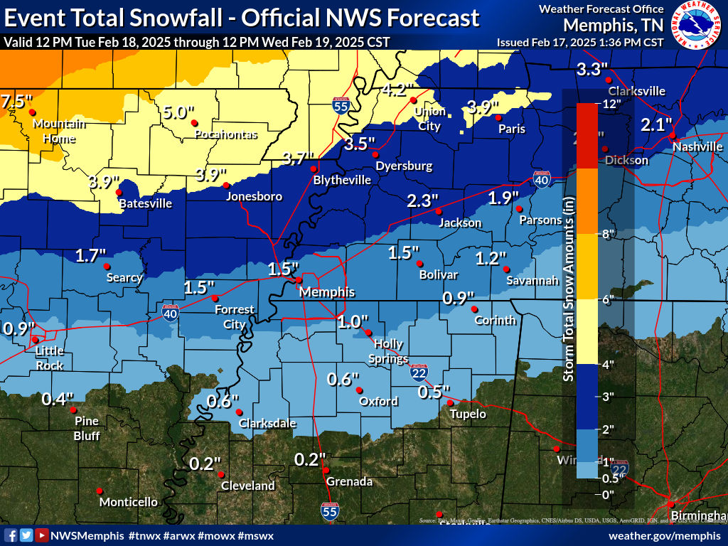
Impacts likely, particularly to area roadways
Because the storm is moving through overnight, the biggest questions are around transportation, particularly the next morning. Wednesday morning’s commute will likely be challenging given temperatures dropping into the lower 20s. Continued cloud cover on Wednesday, which will keep the sun from accelerating the melting process, could delay road condition improvements. In areas that see some sleet or freezing rain Tuesday evening, roads might take even more time to improve.
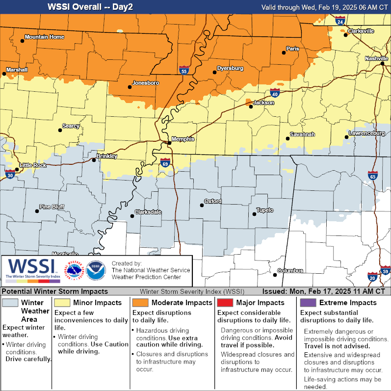
Melting on subsequent days, even of just a couple of inches of snow, will be determined by the effectiveness of road pre-treatment, and snow removal in some cases, and the power of the sun’s rays on Thursday and Friday as clouds will depart. Sunshine could be offset though by the continuation of subfreezing temperatures. Any melting that takes place will refreeze each night as temperatures plummet.
Near-record cold air sticks around to end the week
If you are hoping for a quick warm-up, the arrival of an Arctic airmass on the heels of the storm will not be welcome news. Some of the coldest air of the season arrives Thursday as morning low temperatures start near ten degrees (near the record of nine degrees set in 2021) with wind chills near zero. Afternoon highs, even with sunshine, will remain nearly ten degrees below freezing.
Similar low temperatures are expected Friday morning, which might break the record low for the date of 15 degrees. During the day, temperatures will only peak near freezing, also closing in on a record. Slowly moderating temperatures are expected over the weekend.

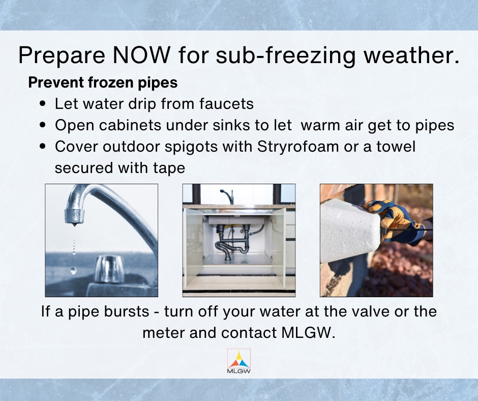
Until then, take cold weather precautions for a few days starting Tuesday night, including opening cabinet doors to allow warm air around pipes, dripping indoor faucets that back up to exterior walls and ensuring pets have a warm place to stay! Thankfully, temperatures are forecast to be back above normal early next week.
Erik Proseus
MWN Meteorologist
—
Follow MWN on Facebook, Twitter/X, BlueSky, Threads and Instagram for the routine updates every day!
Visit MemphisWeather.net for the latest weather information and our MWN Forecast for Memphis and the Mid-South
Looking for a way to support us? Click here for one-time or recurring options! Thank you!







