

Since mid-March, severe weather season seems to have been in full swing with severe weather events each of the last 3 weekends. We’re now staring down a multi-day hazardous weather event that starts with a bang Wednesday evening, and then drones on for at least 3 more days in the form of additional storms and waves of heavy rain. Let’s dive into what we know right now (Tuesday evening).
Wednesday severe weather threat
The very pleasant spring weather Monday and Tuesday (that trailed severe storms on Sunday evening), is about over. Southerly flow is reestablished overnight as a large low pressure system moves into the north-central U.S., dragging a potent cold front across the Plains and into the Mississippi River Valley Wednesday. Ahead of it, very gusty south wind to 40+ mph on Wednesday causes a surge in unseasonably warm and moist air into the Mid-South.
We’ll be looking at a few showers, but mainly “hot” and humid weather during the day as highs reach the mid 80s and dewpoints linger in the mid 60s. It’ll feel like early summer. All of that heat and humidity, strong wind at the lower and upper levels, and wind shear that is the result of an approaching trough, will put the Memphis area in a potentially dangerous scenario for severe thunderstorms capable of large hail, damaging wind, and even potentially strong tornadoes. (The tornado threat is higher with this event than any we had in March.) The Storm Prediction Center has placed the area in a level 4 of 5 (Moderate) risk zone, driven by the tornado threat, as well as the possibility of large hail and high wind.

Storms should approach from the west during the afternoon as they increase in number before reaching the greater metro by evening. As they approach, they’ll also slow down their eastward progress as the front creeps nearly to a halt, resulting in a few hour period for possible strong to severe storms over the metro during the late evening hours. The highest likelihood for severe weather is likely 8pm-1am, though a few storms are possible as early as 6pm. Any early threat is likely to be isolated supercells that could bring severe weather, but are less likely to occur than the main round. The severe weather threat wanes after midnight, even if rain and thunder do not.
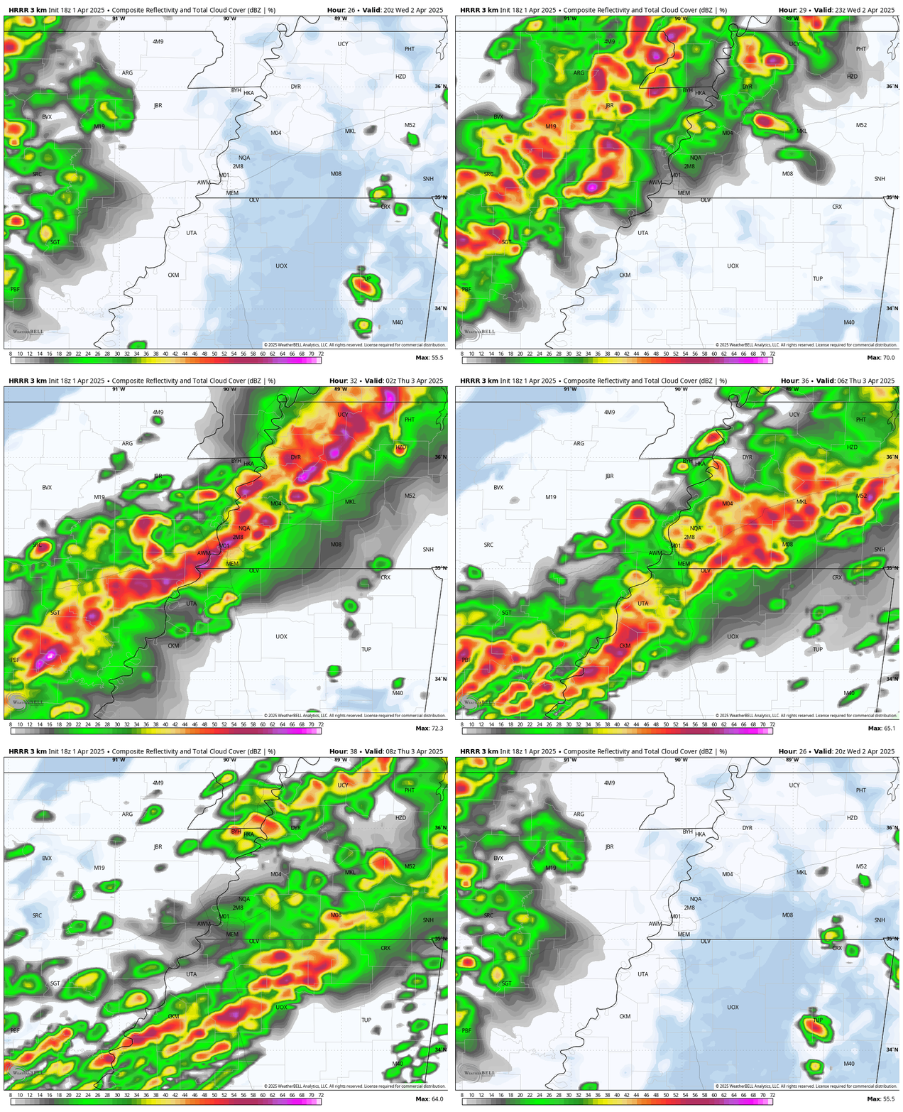
Thursday and Friday – heavy rain and possible strong storms
With the front effectively stalling out somewhere near the I-40 corridor (exact location TBD and likely shifting a bit), rounds of rainfall – some heavy – and thunderstorms are expected to occur over the course of these 2 days. No dry hours can be identified at this point, but there will likely be some between round of heavy rain.
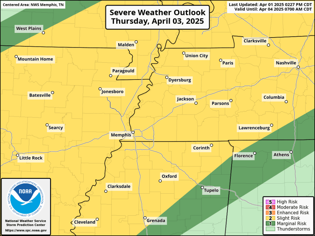
In addition, a Slight Risk-equivalent (level 2) severe weather threat is in effect both days. With very warm, moisture-laden air in place and strong wind aloft, a few storms each day could produce damaging wind or hail, though the tornado threat will be fairly low each day. Expect a few inches of rainfall, especially along and north of I-40 into northeast AR and northwest TN, resulting in rising rivers and streams that will likely result in flooding, as well as urban flooding from downpours and continuous runoff.
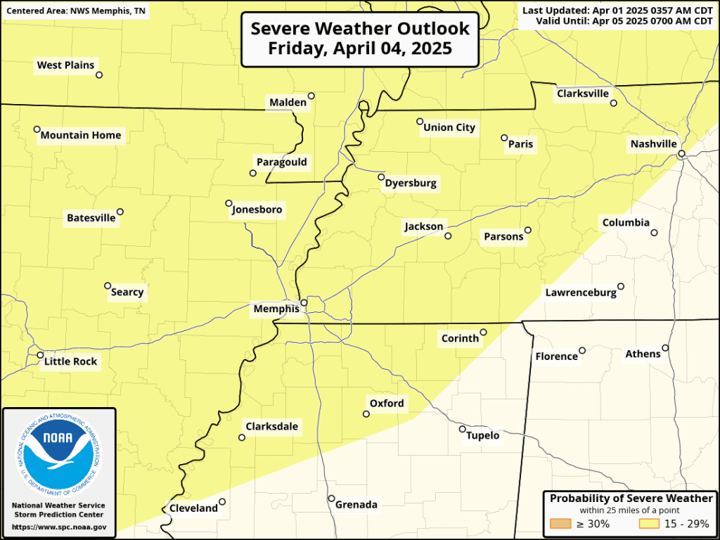
Exercise caution while out and about and avoid those areas known to hold water. The most likely time for a more extended “break” from steady rain is likely to be late Friday into Saturday morning, but subject to change.
Saturday – one last round of heavy rain and strong storms
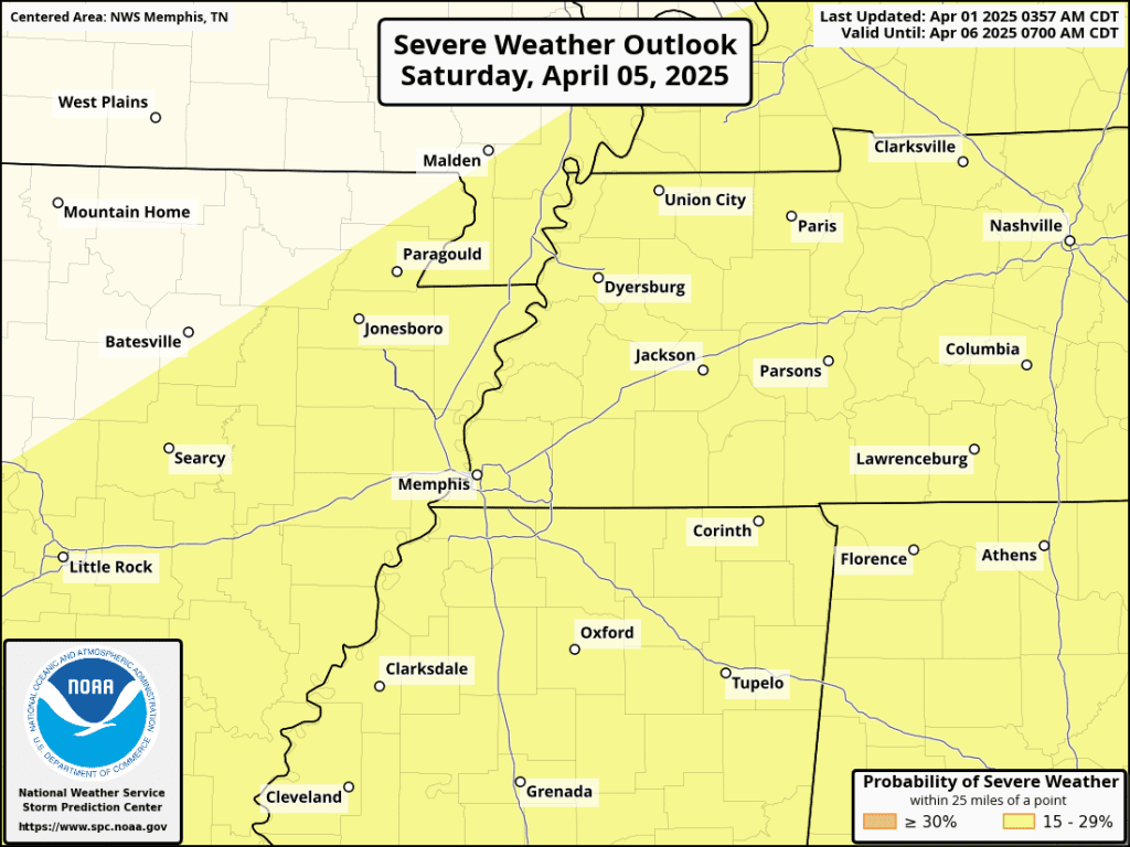
Finally, another trough of low pressure will push through late Saturday into Saturday night. This will finally force a cold front all the way through the region and to our east by Sunday. This “kicker” system could bring another round of severe storms (though right now not likely to be as strong as Wednesday night) with strong wind and hail possible. Timing is most likely late Saturday or Saturday night and additional heavy rain will bring final event totals to somewhere between 6-8″ in the immediate metro to 10-15″ in areas northwest of the metro in eastern AR and northwest TN.
The NWS is calling this a potentially “generational” flooding event, the likes of which we probably haven’t see in at least 10 and perhaps 15 year (some recall May 1-2, 2010). The good news: starting sometime Sunday when rain is finally gone, most of next week looks cooler and calm. I’m here for it!
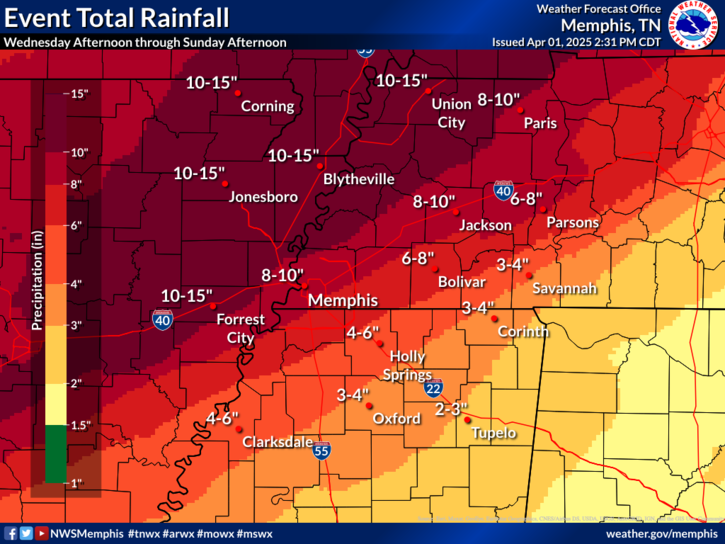
Bottom line: REMAIN WEATHER AWARE for the next several days. Changes are LIKELY to this forecast, though the overall scope is pretty well defined. First up is to prepare for Wednesday night’s severe storms and make sure places where water should flow are clear and ready for it! We’ll bring you the latest information each day as we see it on our social media channels.
Erik Proseus
MWN Meteorologist
—
Follow MWN on Facebook, Twitter/X, BlueSky, Threads and Instagram for the routine updates every day!
Visit MemphisWeather.net for the latest weather information and our MWN Forecast for Memphis and the Mid-South
Looking for a way to support us? Click here for one-time or recurring options! Thank you!







