


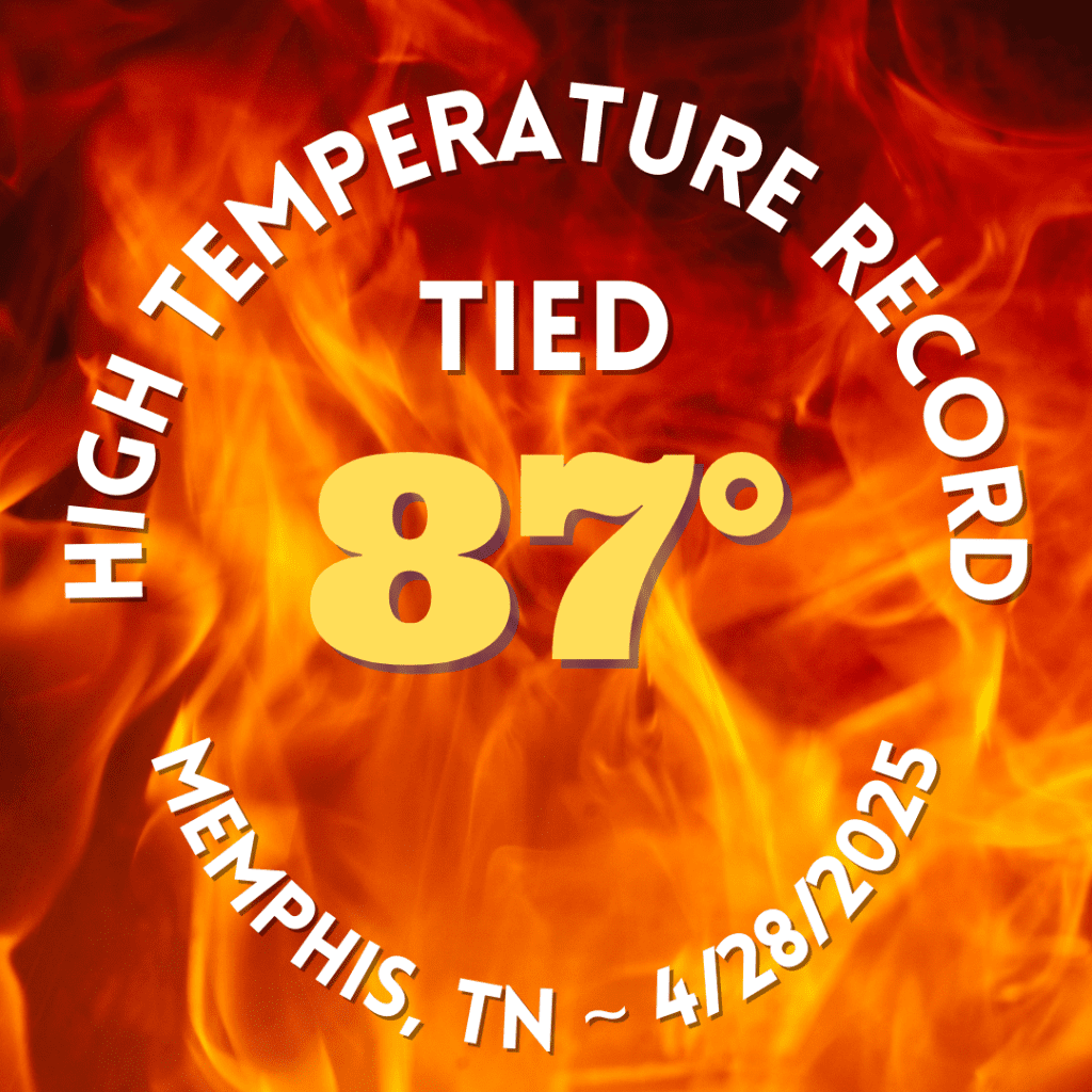
The weather has settled quite a bit from multiple severe weather events from mid-March through the first week of rain. After a couple of dry weeks, scattered showers and thunderstorms have popped up in the past week. Between those events, we’ve had some pretty nice spring days! However, the start of the week has brought a taste of early summer with highs in the mid to upper 80s. We even touched 90 degrees in Bartlett this afternoon and tied a record high at Memphis International Airport at 87 degrees! So what’s ahead for the rest of the week? Glad you asked!
Tuesday – warm and humid
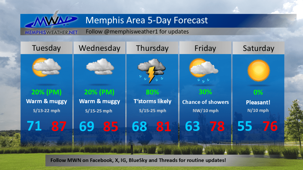
Well above average temperatures continue into Tuesday and Wednesday, though record highs are warmer than today’s 87. We’ll still have a heat index near 90 on Tuesday and with a major storm system well to our north stalling out just north of the Mid-South, an isolated afternoon shower or thunderstorm will be possible. The Storm Prediction Center (SPC) has a level 2 (Slight) risk of a severe storm not too far to our north, but it seems a bit far south based on recent model trends.

Wednesday – warm and humid
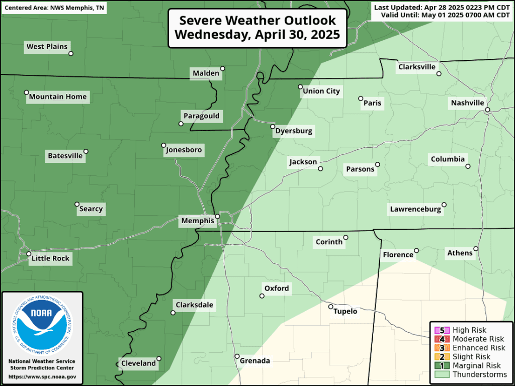
Wednesday brings more cloud cover, continued gusty wind to 25 mph, and highs once again in the mid 80s. With high pressure reasserting itself a bit, the rain chance should be a bit lower during the day. But once again, a slight chance of showers or thunderstorms exists, mainly in the evening ahead of higher chances the later into the night we go. SPC has tagged northern portions of the metro with a level 1 (Marginal) risk for a severe storm mainly Wednesday night.
Thursday – stormy
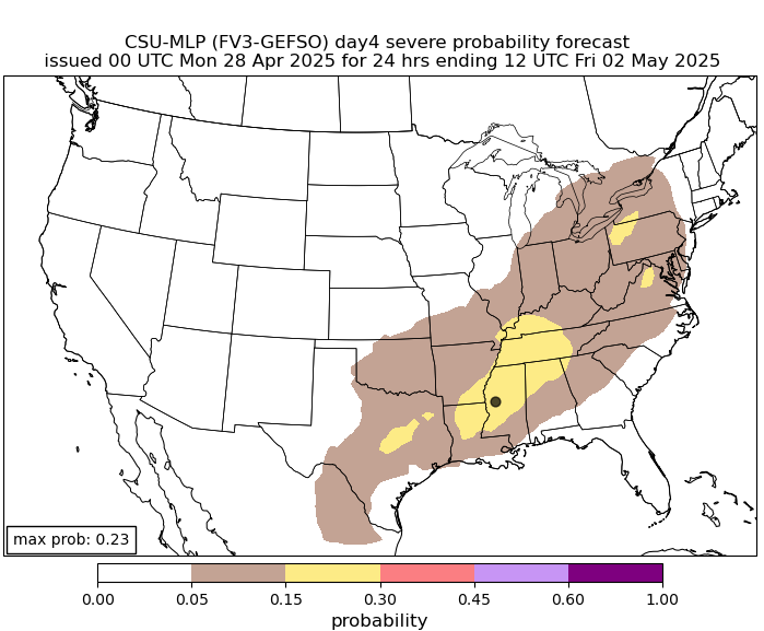
Thursday sees the highest rain chances of the forecast as a cold front finally moves into the Mid-South. Rain chances look to be high for much of the day. While it will not be a washout, there could be bouts of showers and storms most anytime. For now, SPC has not outlined a severe risk, but I would expect we will see at least a level 1 risk as we draw closer in time with a chance that a level 2 risk could be posted by Thursday morning. A few storms could be gusty with some hail.
Friday – lingering rain chance
By Thursday night, most of the precipitation is moving east, but an upper level disturbance will rotate through Friday and could bring one more chance of showers or a thunderstorm. We’ll be keeping a close eye on this, as it is opening night for RiverBeat Music Festival at Tom Lee Park, which Cirrus Weather (parent organization of MemphisWeather.net) serves as official weather provider for. We’ll be on-site keeping festival organizers apprised of any weather hazards so that they, in turn, can keep patrons safe!
The weekend
Looking to the weekend, fabulous weather is expected for the music festival, as well as any outdoor plans you may have. With low humidity and abundant sunshine, morning lows in the 50s and highs in the 70s will feel amazing! Plan to spend as much time outside as you can before “pre-summer” (then real summer) likely arrives as we head into May!
One final note on a crazy month of April: the official precipitation total for the month currently stands at 14.33″ inches. This makes April 2025 the seventh wettest month on record in Memphis. Of course, what is even more unusual is that over 12 inches of that fell between the 2nd and 5th!
Erik Proseus
MWN Meteorologist
—
Follow MWN on Facebook, Twitter/X, BlueSky, Threads and Instagram for the routine updates every day!
Visit MemphisWeather.net for the latest weather information and our MWN Forecast for Memphis and the Mid-South
Looking for a way to support us? Click here for one-time or recurring options! Thank you!







