

While it took a while to warm up (the first 90-degree day of 2025 was almost 2 weeks late), the official arrival of summer seems to have lit a match under Mother Nature!
Official start of summer brings heat wave to the eastern U.S.
The summer solstice occurred Friday night at 9:42pm and the average day length (amount of time the sun is above the horizon) has reached its peak of 14 hours and 31 minutes. The days will slowly get shorter going forward, however we know that the hottest days are yet to come as temperatures lag the amount of daylight by a significant amount. (Why? This short video explains.)
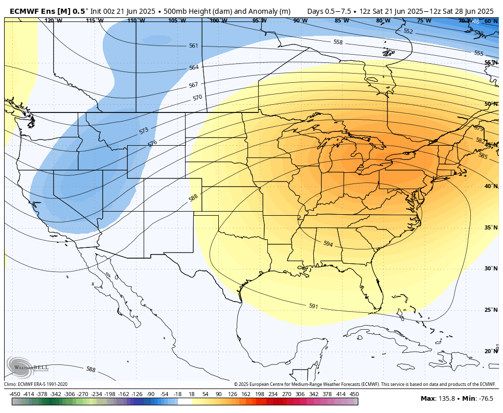
If you have been watching national weather stories, you know that the first major heat wave of 2025 is producing major headlines to our north where records will be broken across the Ohio Valley and Great Lakes into the Northeast U.S.
Local effects
Locally though, the heat is also ramping up to above normal levels, while humidity (more specifically, dewpoints) remain elevated thanks to all of the recent rain and southerly wind flow off the Gulf. The very strong high pressure over the eastern U.S. is also building over the Mid-South and it looks to remain parked over the region for at least a week. That means very little variation in the forecast from day to day.
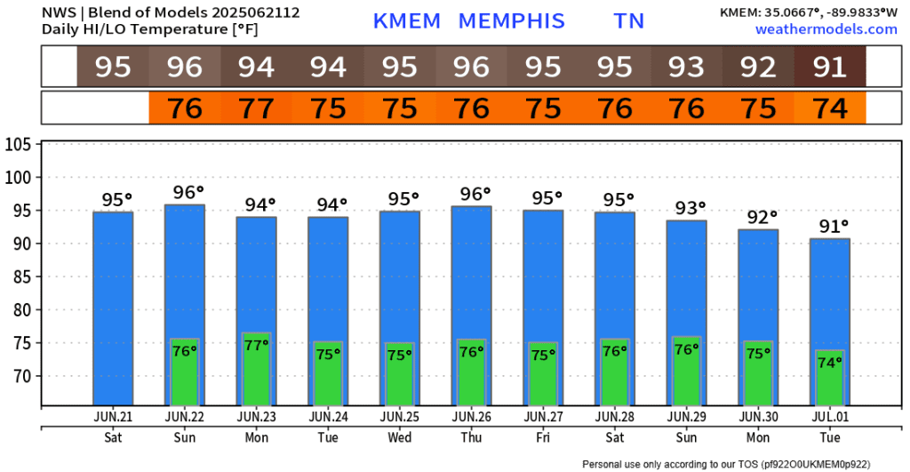
The forecast details include:
- warm mornings that start in the 70s
- afternoon high temperatures that reach the mid 90s
- light southerly wind
- uncomfortably high dewpoints in the mid 70s, resulting in peak heat indices in the 105-110° range
- small chances of thunderstorms (10-20% daily), as every once in a while a “fly in the ointment” disturbance provides a little “lift” in the hot and humid air that becomes a thunderstorm.
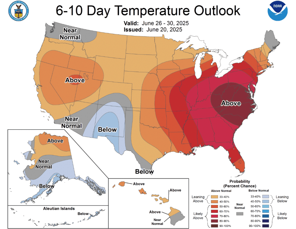
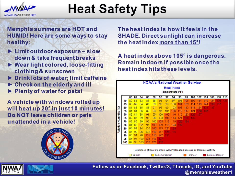
Heat indices are quickly ramping up to dangerous levels, not only for those vulnerable to excessive heat, but also for healthy people who are used to being “in the elements” but are not yet acclimated. Heat Advisories, which are issued when the heat index is expected to reach 105 degrees, have been issued through the weekend. With similar conditions continuing well into next week, those will likely be extended.
Staying safe in the heat
Persistent heat is not just a problem during the hottest part of the day, but has cumulative effects as well. So while it may not bother you much the first couple of days, heat can take a toll when one is exposed repeatedly. Make sure you are taking it slow while outdoors – take frequent breaks, remain hydrated (with water), wear light colored clothing, and listen to your body so you do not overextend. Also be sure to check on the vulnerable, including the elderly and ill or those without sufficient places to stay cool, and of course your pets. And NEVER leave a child or pet in a vehicle unattended!
Erik Proseus
MWN Meteorologist
—
Follow MWN on Facebook, Twitter/X, BlueSky, Threads and Instagram for the routine updates every day!
Visit MemphisWeather.net for the latest weather information and our MWN Forecast for Memphis and the Mid-South
Looking for a way to support us? Click here for one-time or recurring options! Thank you!







