

Remember back in late May and early June when we were talking about how late the first 90-degree day of the year was, nearly 2 weeks later than usual? Seems like months ago! In the past 30 days, Memphis has only failed to reach 90 degrees on 3 occasions, so the heat is definitely on!
While we haven’t had extreme heat just yet (100 degrees has still been out of reach), the frequent mid 90s and near-daily Heat Advisories remind us that Memphis does indeed have “dog days” in the summertime! Unfortunately, we are staring down the barrel of what could be a prolonged heat wave with temperatures well above average and touching the century mark not out of the question.
As moisture from a former non-tropical low that brought heavy rain to the Gulf coast starts to push out tomorrow and rain chances diminish from ‘possible’ to ‘unlikely’ heading into next week, high pressure builds overhead. This “heat dome” as you may hear it referred to appears to have staying power too.
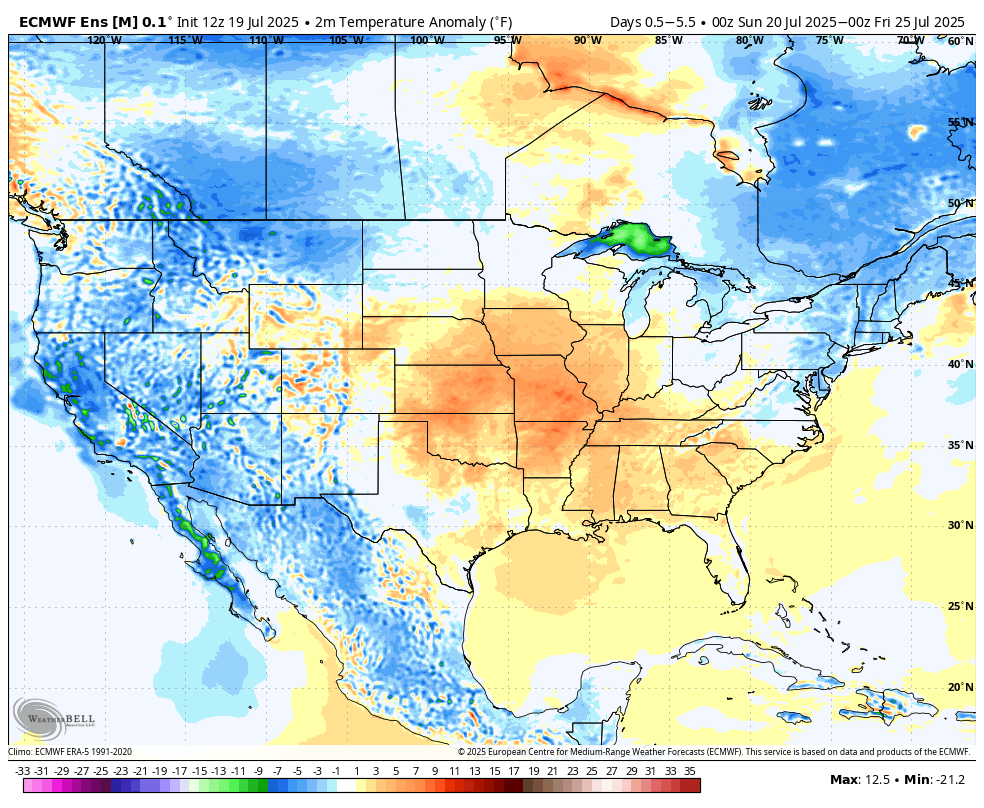
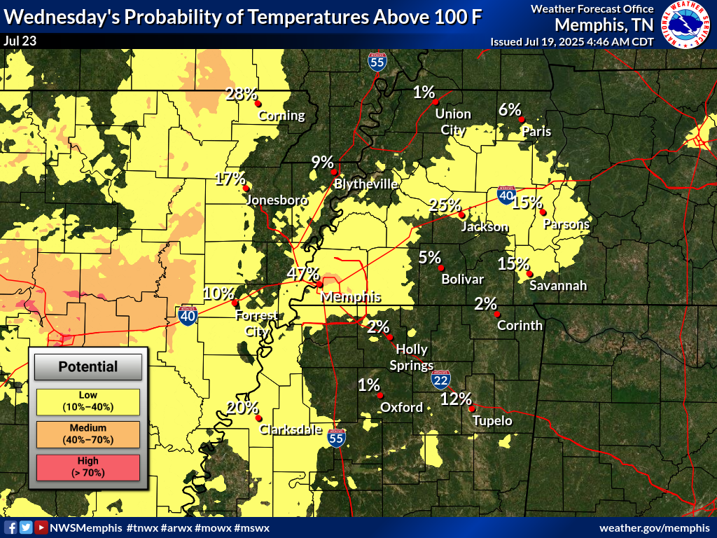
The immediate forecast calls for mid to upper 90s arriving Sunday and continuing well into next week. Right now the hottest days appear to be Tuesday through Thursday when some areas around the region could reach 100 degrees.
In addition, dewpoints (the atmospheric measure of moisture that drives the Muggy Meter into the intolerable range) will be in the low to mid 70s. That means heat indices will reach the dangerous level of 105 daily and likely will top out near 110 degrees – or higher – in some places.
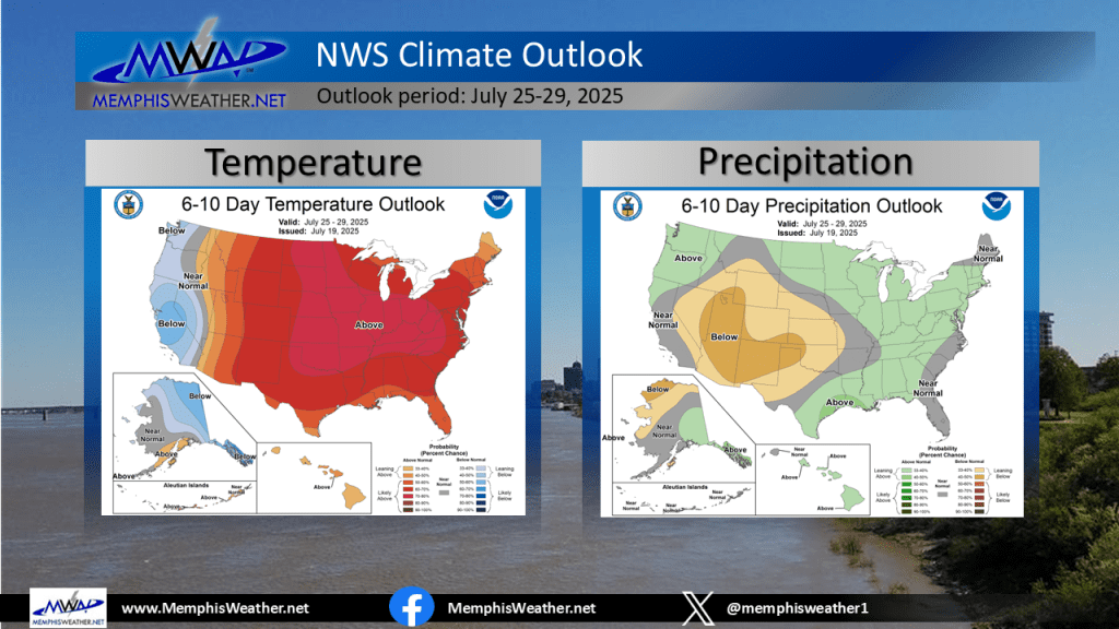
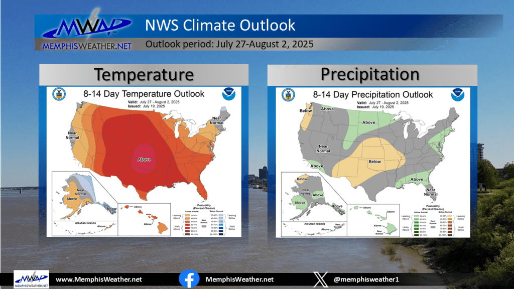
Looking further out, signals point to the heat dome migrating a bit from the eastern U.S. back west, but still spreading over the Lower Mississippi Valley on its eastern edge. That means we remain under its influence perhaps past next week and towards the first of August.
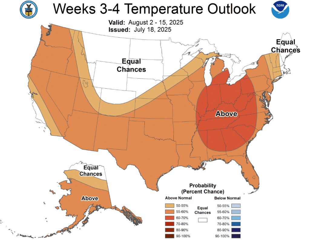
Unfortunately, with strong high pressure aloft, rain chances will also be spotty at best and near zero most days. The ground has started drying out the past week or so from spring and early summer rain, so expect to start seeing the lack of moisture affect our greenspaces in the coming week or two.
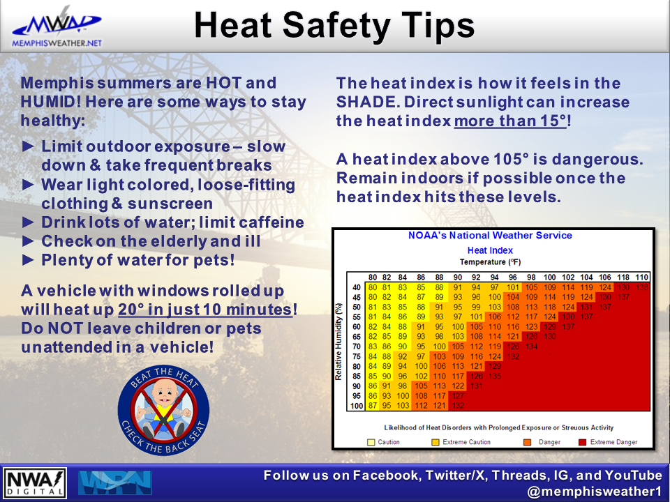
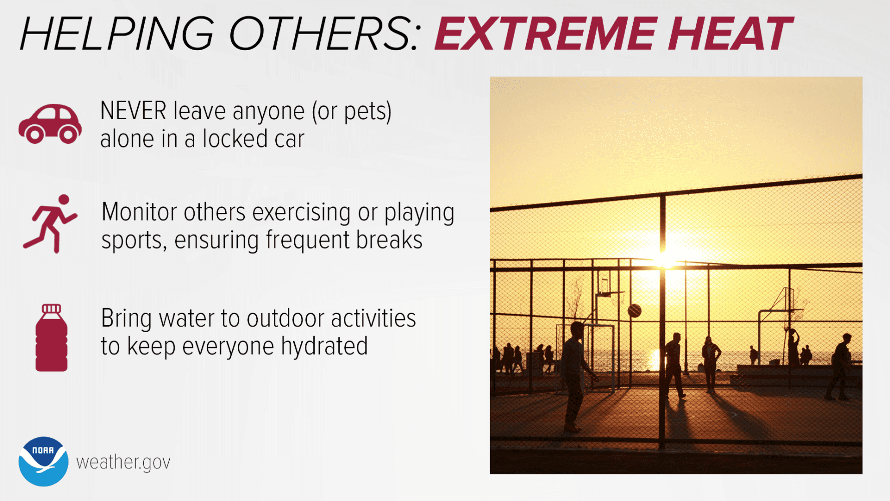
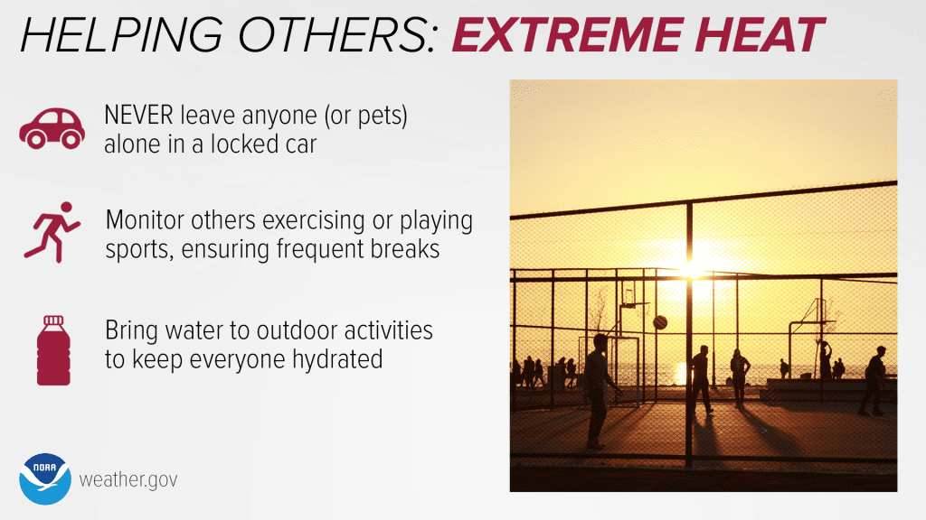
From a precaution perspective, obviously prolonged heat starts to take a toll where short bouts of it are more tolerable. Be sure you are taking heat precautions daily and monitoring those in your circle who are very young, or older and not as resilient. Avoid being outdoors in the afternoons and keep plenty of cool water around if you are working outdoors, as well as keeping your outdoor animals shaded with a fresh water source. And of course, never leave an unattended vehicle running with occupants!
Erik Proseus
MWN Meteorologist
—
Follow MWN on Facebook, Twitter/X, BlueSky, Threads and Instagram for the routine updates every day!
Visit MemphisWeather.net for the latest weather information and our MWN Forecast for Memphis and the Mid-South
Looking for a way to support us? Click here for one-time or recurring options! Thank you!







