

The heat of the past two months has felt unrelenting. After finally touching 90 degrees on June 20th for the first time this year, every day from June 20th to July 31st reached at least 89.
A few days at the beginning of August “only” topped out in the mid 80s, but the next two weeks were all above 90 once again, including three straight days of 100+ (and one record high) earlier this week.
Finally, following a cool front Wednesday night, we were back down to 89 Thursday and Friday. Lower 90s are projected for this weekend, although with drier air in place, mornings and evenings are not bad and afternoon heat indices remain below 100.
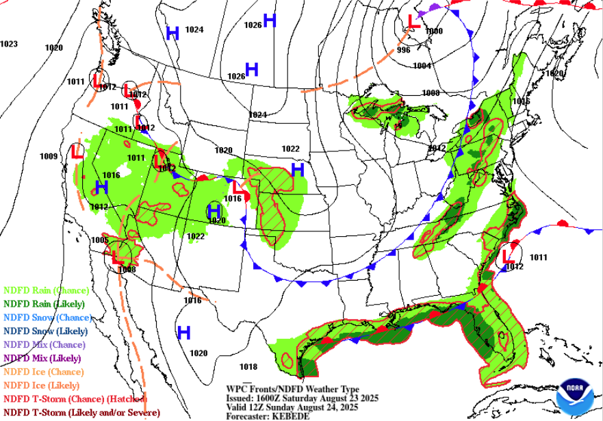
A dry cold front early Sunday will finally bring an airmass of Canadian origin into the area next week, which should escort us off of Hell’s Front Porch and into False Fall! And none to soon. The week ahead features highs generally in the low to mid 80s and morning lows in the lower 60s in the city and even some upper 50s in areas outside the 240 loop and urban core!

Overall, dry weather will persist, though an upper level disturbance (moving through the trough of low pressure that is responsible for our cool down) could bring some showers late Monday night into Tuesday. With the additional cloud cover, it’s entirely possible that we don’t make it to 80 degrees on Tuesday.
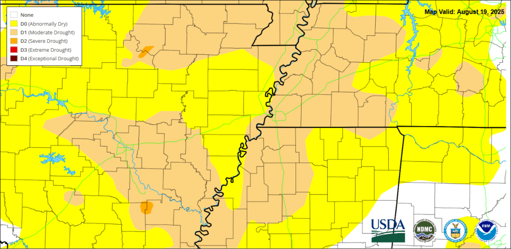
The dry conditions will not help a drought situation that has quickly developed in the past few weeks across the region. Some might say “what drought?” (like the fine folks in the southeastern suburbs who have been hogging all the scattered thunderstorms of late and still have beautiful green grass to show for it). But most of us have had precious little beneficial rainfall in the past 3-4 weeks, and the vegetation is quickly drying up.
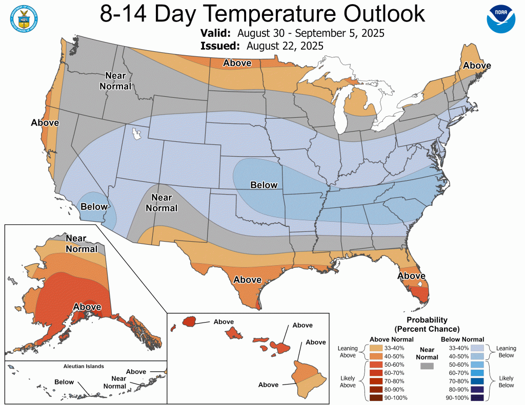
Given the current week 2 temperature outlook, it looks like the summer furnace may be shutting down for this year, as below average temperatures are projected into early September. Sure, we can get some hot days yet, but generally the heat+humidity combo meal is harder to come by after September 1. Maybe, just maybe, the Heat Advisories and Warnings for 2025 are now in the rearview mirror and we can look forward to pumpkin spice lattes again before long! At this point, I think we might all be ready for it.
As always, you can find the latest daily MWN Forecast by visiting our website at www.MemphisWeather.net, which is optimized for the mobile experience!
Erik Proseus
MWN Meteorologist
—
Follow MWN on Facebook, Twitter/X, BlueSky, Threads and Instagram for the routine updates every day!
Visit MemphisWeather.net for the latest weather information and our MWN Forecast for Memphis and the Mid-South
Looking for a way to support us? Click here for one-time or recurring options! Thank you!







