

After an early taste of spring we experienced of late, winter will briefly return across the region this weekend into the start of the work week. A cold front will pass through today, bringing colder Canadian air behind it, lasting through Tuesday morning.
Highs Sunday will only reach the mid-40s, while Monday will likely stay in the upper 30s to near 40. Low temperatures will drop to the mid-20s both Sunday night and Monday night, resulting in the potential for a hard freeze Monday and Tuesday mornings.
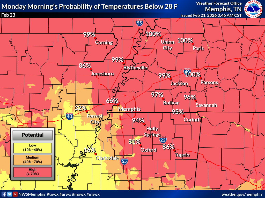
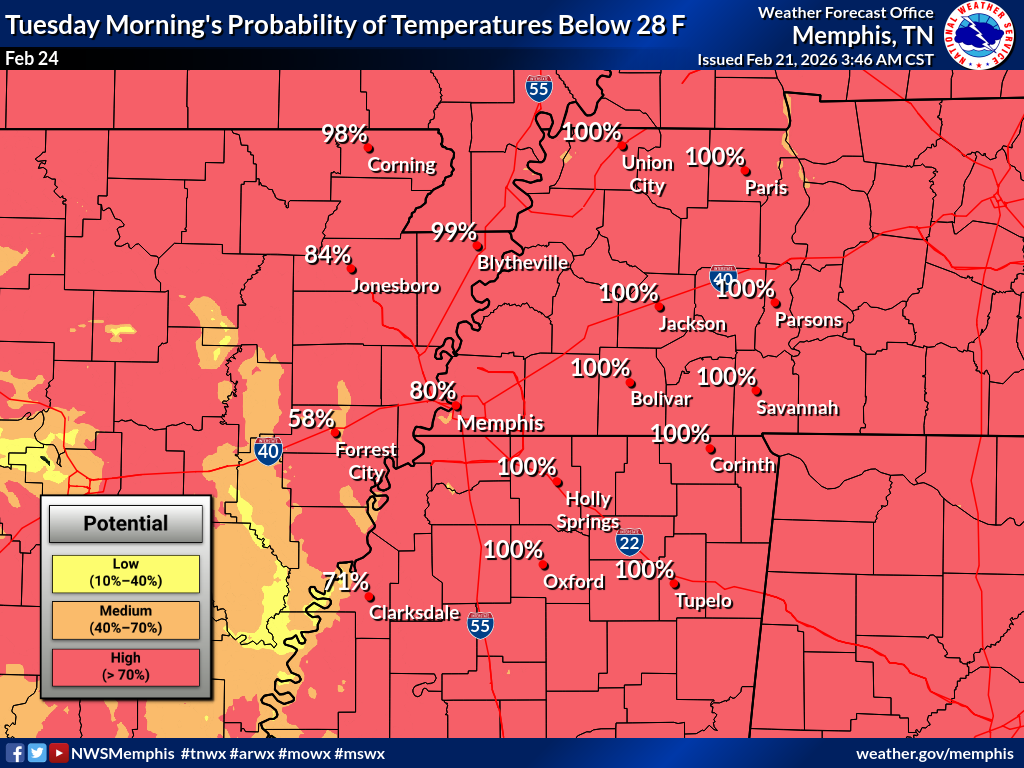
The brief shot of chilly air will be short-lived, as the area will see southerly flow return by mid-week. This will result in above-average temperatures, with highs returning to the 60s by Wednesday. The addition of warmer air and a low-pressure system will bring rain chances by mid-week.
A low pressure will track across the northern Plains into the Ohio Valley, with its cold front moving through the region and bringing rain chances. While uncertainty remains high regarding where the low will track and the strength of the cold front, showers seem likely, though with minimal thunder chances on Thursday.
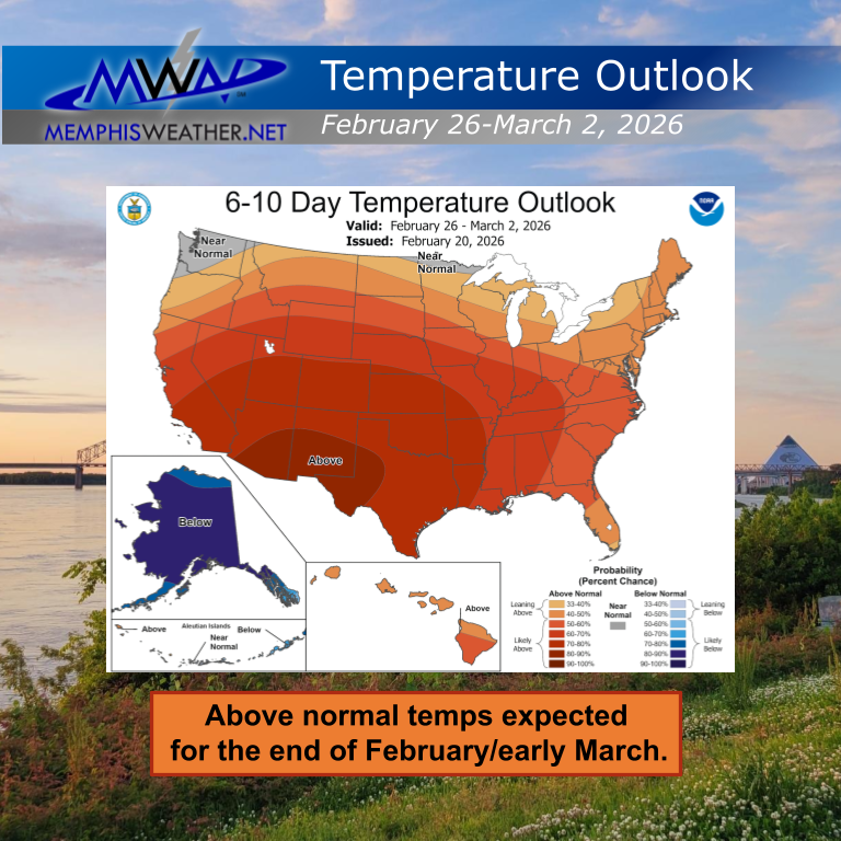
As February ends and winter starts to lose its grip, severe weather becomes the next focus across the region, as March typically brings increasing severe weather odds. It is important to be prepared for severe weather season and to know your safe place ahead of time.
An interior room on the lowest floor that is away from windows and outside walls, a basement or storm shelter, or a bathroom or closet are good examples of a safe place to go to when severe weather strikes.

Knowing how to receive severe weather warnings is crucial. Phones and other forms of media are great ways to receive severe weather information and warnings of severe weather. We highly recommend our in-house severe weather alert app, StormWatch+, which will wake you up for the most urgent warnings and allows you to program multiple locations to monitor, in case you are keeping an eye out for an elderly relative or college-aged children!
In addition, having a battery powered NOAA radio if the power goes out is highly encouraged. Additionally, having an emergency kit with a first aid kit, several days of water and food (including for pets), clothes and shoes, prescriptions, cell phones and chargers, and multiple forms of payment are highly recommended.
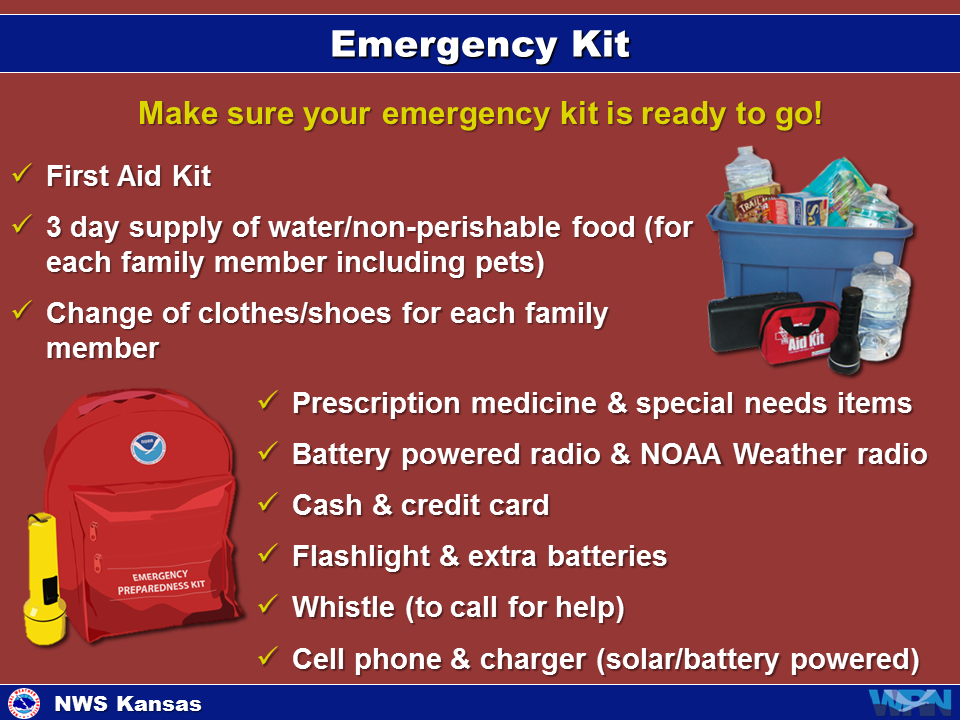
Taking simple steps now can make a significant difference when severe weather strikes. Be prepared, not scared!
Aidan O’Brien
MWN Social Media Intern
—
Follow MWN on Facebook, Twitter/X, BlueSky, Threads and Instagram for the routine updates every day!
Visit MemphisWeather.net for the latest weather information and our MWN Forecast for Memphis and the Mid-South
Looking for a way to support us? Click here for one-time or recurring options! Thank you!







