

March ended up as the third warmest on record in Memphis and the hottest for the United States as a whole, dating back to 1895. While nearly the entire country experienced above average temperatures, the southwest portion of the nation experienced temperatures that would be above average if it were April!
We experienced a very nice week with temperatures starting near to slightly below average, but the warming trend resumed as the week went on and we’re now finding ourselves a few degrees from record highs once again. Fortunately, a year after a wild week of severe weather, there was no rain this week and humidity levels were also suppressed, leading to some beautiful springtime weather.
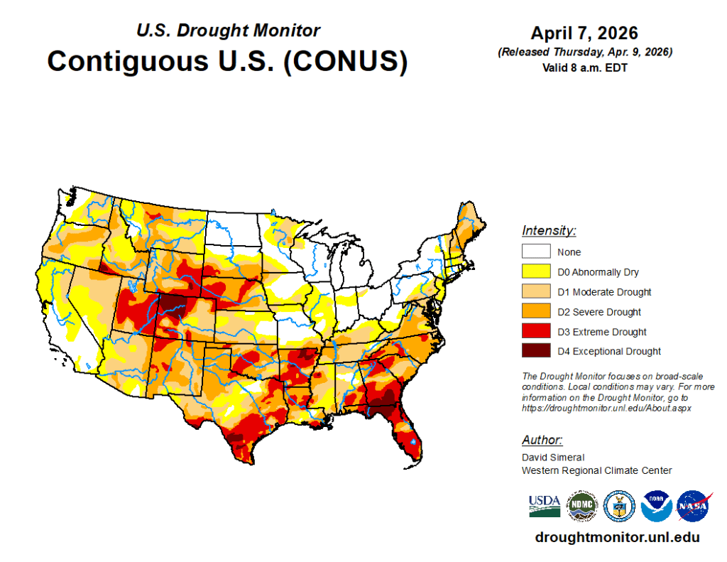
However, drought conditions across the southern U.S. won’t improve without some rain. This week might bring some relief for some areas top our west, but maybe not much locally despite scattered rain chances.
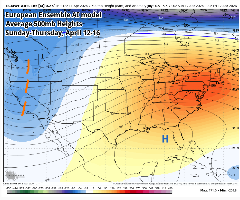
It will be a busy week across the central United States with an upper level trough dominating the western part of the country and a large upper level high across the southeast. That puts the area between those systems under the gun for multiple rounds of thunderstorms with severe weather likely.
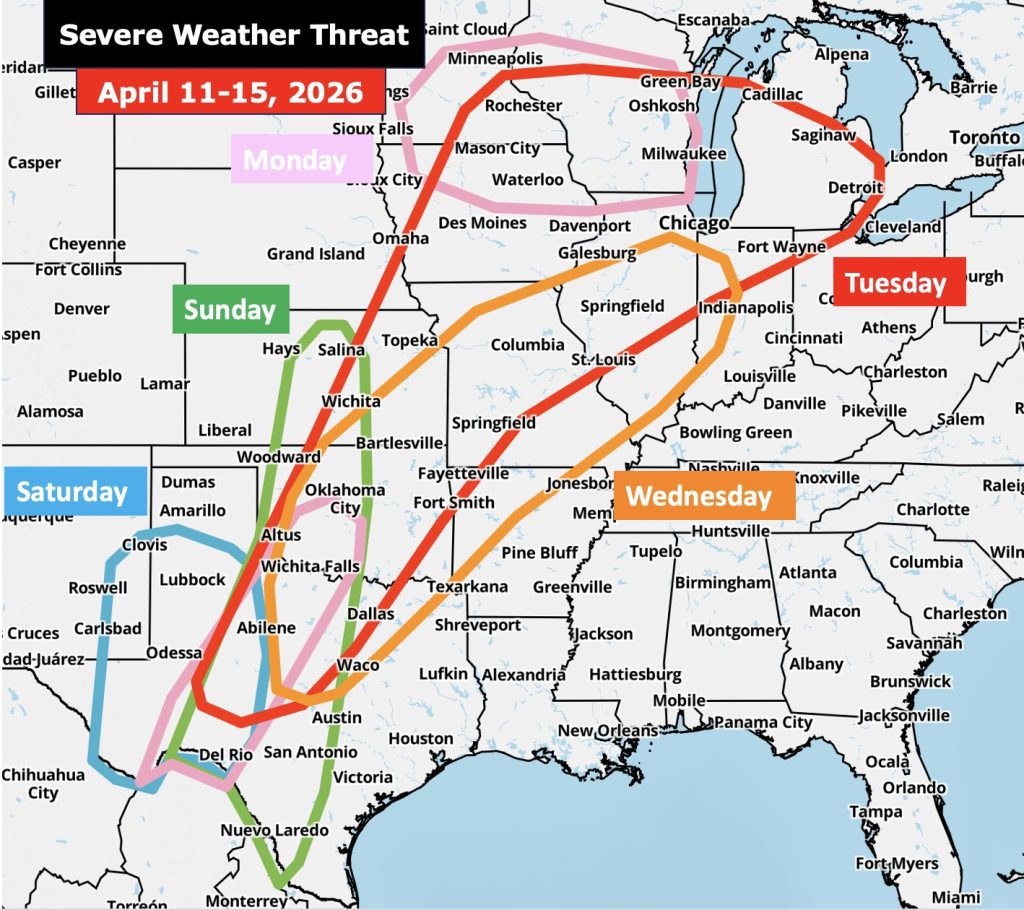
That high pressure system anchored over the southeast will bring record-breaking heat to areas southeast of Memphis, though we will be well above average temperature-wise this week as well. It will also serve to keep severe weather to our west for much of this week until the ridge of high pressure starts to break down late in the week.
Locally, expect continued warm conditions for the coming week with humidity (dewpoints) increasing, making the air more sticky and morning lows warmer, starting Monday. A weak upper level impulse could bring a few showers after midnight Sunday night and into Monday, but rain chances won’t help the drought and we’ll still reach the 80s Monday. Tuesday and Wednesday looks dry and very warm as storms remain well to our west. Passing clouds from those storms could limit sunshine but expect mid 80s for highs.
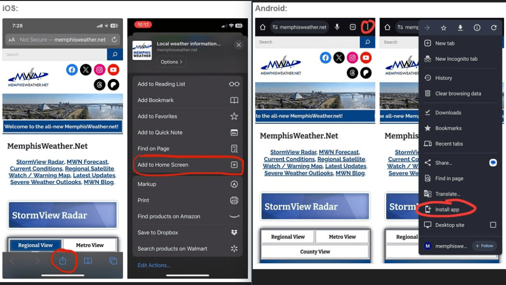
It looks like a decent chance of showers and thunderstorms arrives Thursday, though severe weather threat is limited. After a very warm (hot?) day Friday where we could threaten the 90 degree mark for the first time this spring, a front arrives next weekend with a better chance of rain and moderating temperatures a week from now. Our full week-ahead forecast is always available on the MWN website, which you can save to the home screen on your mobile device for an app look and feel!
Erik Proseus
MWN Meteorologist
—
Follow MWN on Facebook, Twitter/X, BlueSky, Threads and Instagram for the routine updates every day!
Visit MemphisWeather.net for the latest weather information and our MWN Forecast for Memphis and the Mid-South
Looking for a way to support us? Click here for one-time or recurring options! Thank you!







