

Though “meteorological summer” (the season defined for record-keeping purposes by weather folks) began June 1, astronomical summer (defined by the position of the Sun relative to the Earth) officially begins Sunday morning at 3:24am.
The recent weather pattern has been fairly unsettled and changing with hot and humid conditions and some gully-washers late last week giving way to a couple of beautiful days to start this week. As of this afternoon though, a warm front has pushed north of the metro, bringing back the humid 70s dewpoints and gusty south wind. That sets the stage for more unsettled weather over the next week or so.
Add in a briefly-named tropical storm (Arthur, the first of the season) that skirts the Texas coast before heading into the Deep South late this week, and there’s a lot going on in the weather world!

Thursday
By Thursday, the Mid-South will be square in the middle of two competing weather systems: 1) a cold front dropping south after delivering what will likely be a significant severe weather event later today north of the Ohio River, and 2) the remnants of Tropical Storm Arthur moving east across Mississippi and Alabama. While the heavy rain associated with the tropical system stays well to our south, the front will deliver scattered showers and thunderstorms on Thursday, especially in the afternoon and evening hours, with some rain lingering overnight into early Friday.
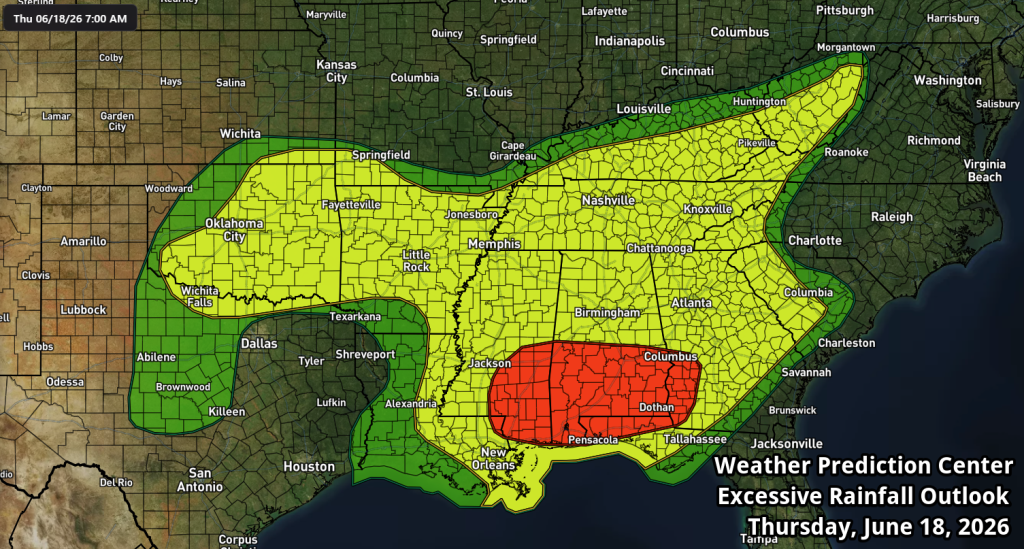
The severe weather threat is a level 1 (Marginal Risk) for the Mid-South as a few storms might produce strong wind gusts late Thursday afternoon into the evening, but the Excessive Rainfall Outlook (below) is a level 2 as some storms will also be capable of scattered heavy rains in a short period of time in a hot and humid airmass.
Friday
By Friday, the front will dip to our south leaving a chance of a lingering shower in the morning, but generally drier conditions with highs in the mid 80s and slightly reduced humidity levels on a northeast wind. It’ll be a good day to get out for outdoor activities before a wetter weekend arrives!
Saturday/Sunday
The more pleasant weather will be short-lived though as the front surges back north by Saturday and brings return chances of scattered showers and thunderstorms from Saturday afternoon through Sunday and into early next week before another front approaches about Tuesday.
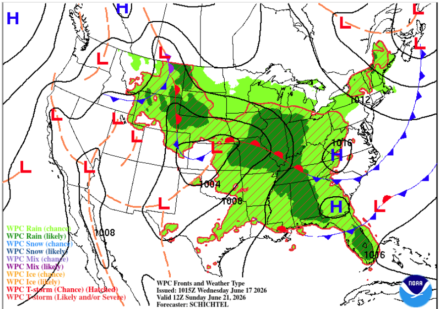
Expect hot and humid conditions this weekend with 40-60% rain chances, including some thunderstorms capable of a brief strong wind gust and localized downpours. Not exactly the best weather for the first weekend of summer, but it won’t be a total washout either! Rain totals through Saturday should be under an inch for most people, but could be 1.5-2.0″ through early next week.
Erik Proseus
MWN Meteorologist
—
Follow MWN on Facebook, Twitter/X, BlueSky, Threads and Instagram for the routine updates every day!
Visit MemphisWeather.net for the latest weather information and our MWN Forecast for Memphis and the Mid-South
Looking for a way to support us? Click here for one-time or recurring options! Thank you!







We have had all kinds of rain and storms here in Ripley Tenn I live right on the Mississippi River bank right out of Ripley and the Mississippi River it’s rising every day Praying for everyone in the area and everyone please stay safe love patsy