

It’s about the time of year we start thinking about what winter will look like in the Mid-South. How cold can we expect it to be? How about icy conditions? Will there be another significant snow event like we saw in January?
Seasonal forecasting of these factors can be challenging at best, but we can use historical trends during various phases of El Niño Southern Oscillation (ENSO) to predict what we might occur during the winter season. While teleconnections like El Niño/La Niña govern weather patterns on a very large scale, there are sure to be exceptions to what is typical. For instance, even if a warm and dry winter is forecast, cold snaps and even snow are not out of the question.
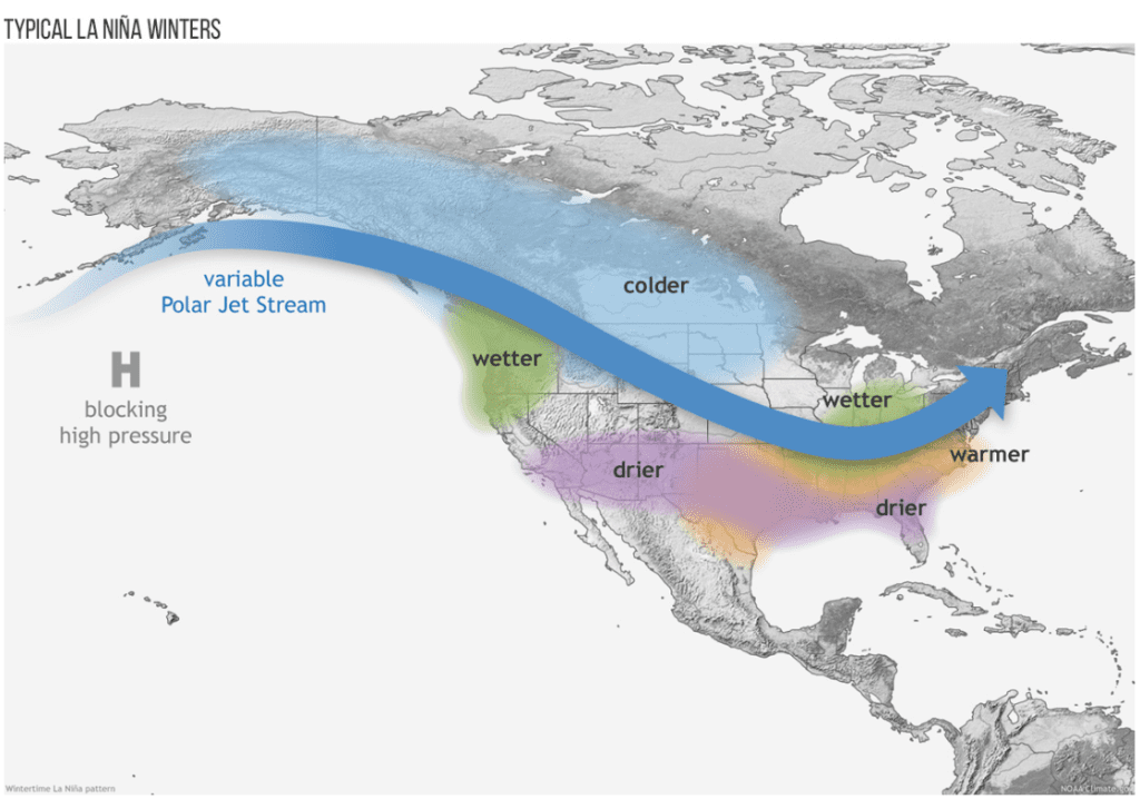
Weak La Niña will drive the overall pattern
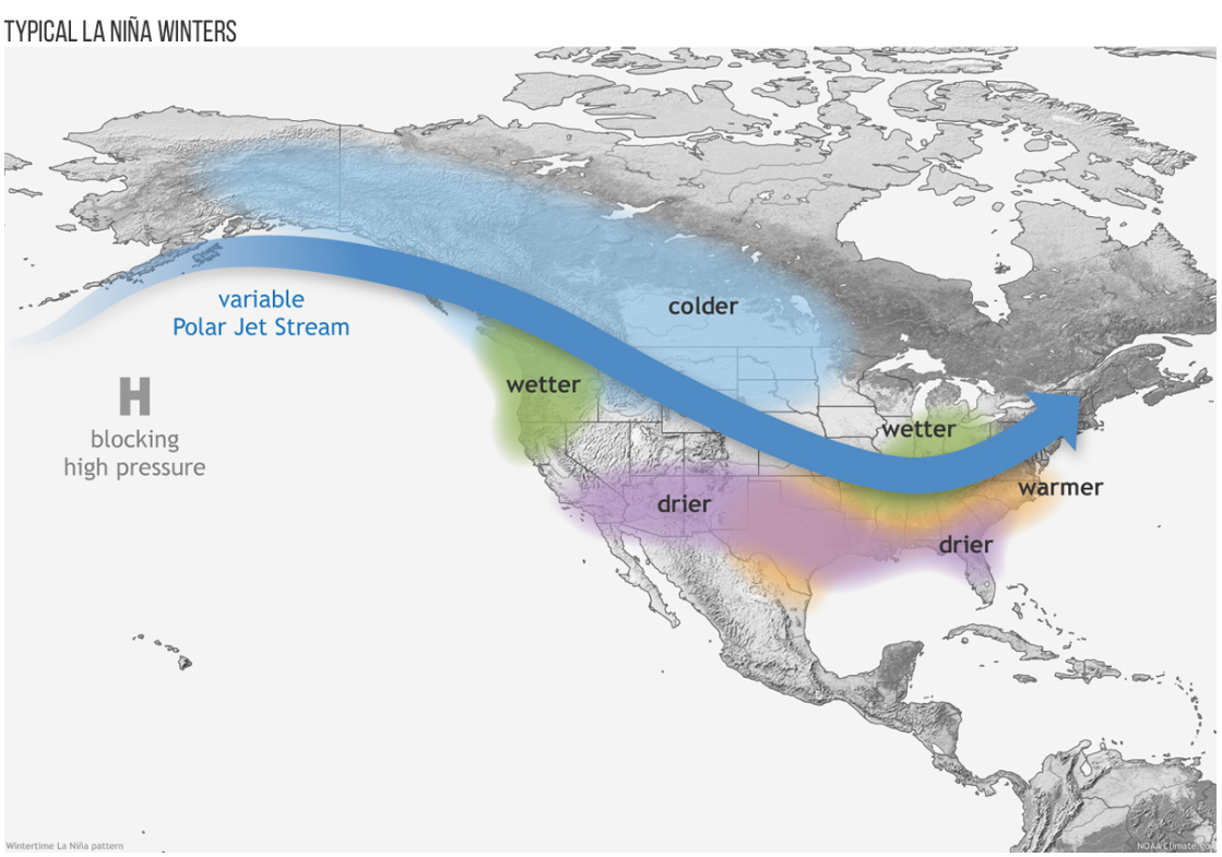
This year, according to the National Oceanic and Atmospheric Administration (NOAA), it is looking likely that a weak La Niña pattern will develop, which implies a warmer winter for us here in the Mid-South with near average precipitation. Since the jet stream position will favor a storm track over the northern United States this winter, and La Niña affects winter precipitation patterns, higher precipitation values are likely to be in the northern regions of the U.S., such as the Great Lakes and the Pacific Northwest, rather than in the Mid-South. Essentially, the jet stream being farther north means that enhanced precipitation should largely remain to our north.
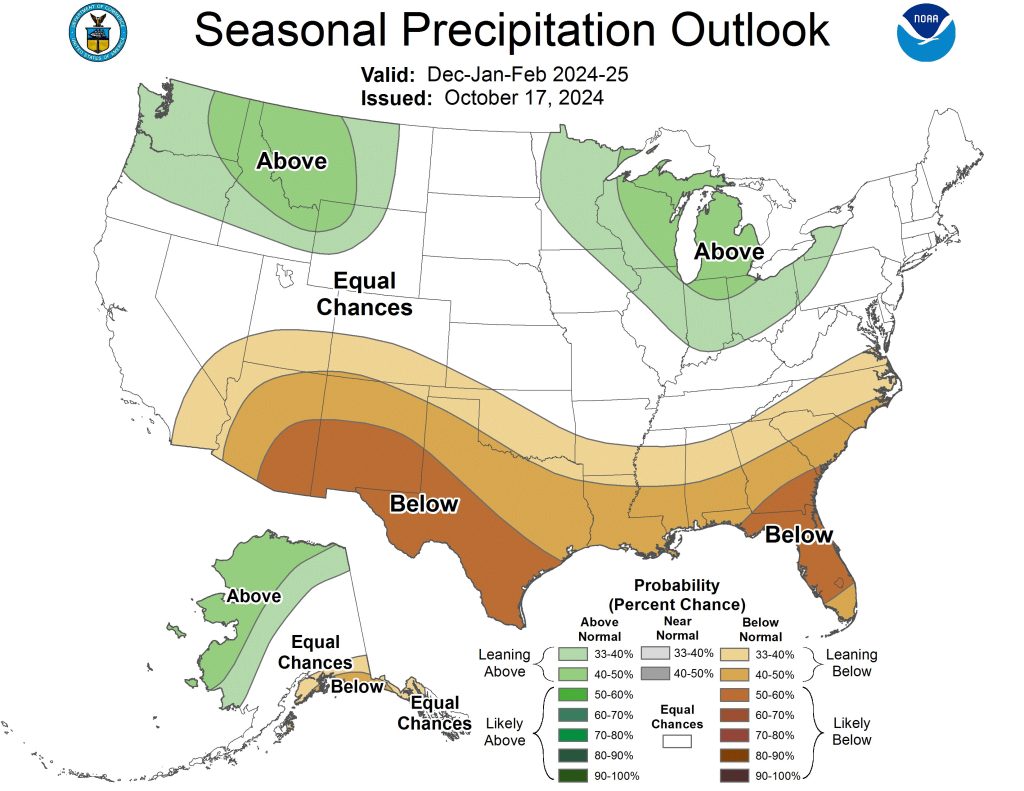
Precipitation trends
While Mid-Southerners are likely more interested in snow, most of our winter precipitation falls as rain. Average precipitation (including melted snow) totals around 14 inches from December though February, so you can expect that to be about what we see this winter. However, as mentioned previously, snow is not out of the question! Memphis has an annual snowfall average of 2.7 inches, but it is important to note that this is derived from widely varying winters. Think about winter 2023 with very little snow, compared to this past winter, when some of us had more than we knew what to do with in January!
Temperature trends
While La Niña affects precipitation patterns, temperature fluctuates as a result of jet stream placement as well. On a continental scale, the Pacific Northwest is likely to be cooler while much of the southern and eastern United States is likely to be warmer to some degree. The most likely scenario is that temperatures would average above historical norms in the Mid-South from December to February. For reference, average low temperatures range from 33-40° while average high temperatures are typically in the 50s, so you will still need the winter coats! A warmer than average winter does not necessarily equate to a WARM winter!
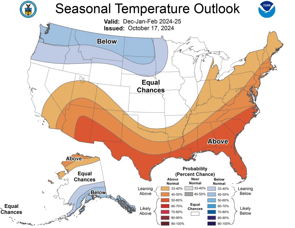
In summary, a La Niña pattern would favor slightly warmer than average temperatures and generally average precipitation in the Mid-South. Remember though that even in a warm winter, there will likely still be a few cold snaps, and perhaps some snow or icy weather.
Average winter temperatures and precipitation for Memphis
| Temperature | Precipitation | |
| December | 44.8° | 5.74″ |
| January | 42.1° | 3.98″ |
| February | 46.1° | 4.39″ |
| Winter Average / Total | 44.3° | 14.11″ |
As mentioned earlier, seasonal forecasting is challenging, but using teleconnections can help give us a general idea of what is likely to occur. While a La Niña winter is what can be largely expected, there are certainly plenty of other teleconnections that are not as predictable and can have strong effects on a shorter-term scale (week-to-week) to counter the typical La Niña pattern.
Once this winter’s La Niña pattern develops, it is uncertain how long it might last. If it persists into spring, the Mid-South could see more severe weather, which is often the case in La Niña springs. That of course is still up in the air this far out, but it’s a possibility as we look past winter into the more distant future.
Lórien Gray
MWN Intern
—
Follow MWN on Facebook, Twitter/X, Threads and Instagram for the routine updates every day!
Visit MemphisWeather.net for the latest weather information and our MWN Forecast for Memphis and the Mid-South







