

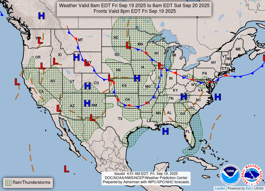
Friday featured little relief from the heat with a weak upper level disturbance moving through. It has provided some rain and storms this morning, which were again short lived and mostly located in northern Mississippi. However, cloud coverage should keep temperatures down a few degrees lower compared to the last several days. Friday Night Lights will be warm but likely dry with temperatures in the 80s.
Drought Update
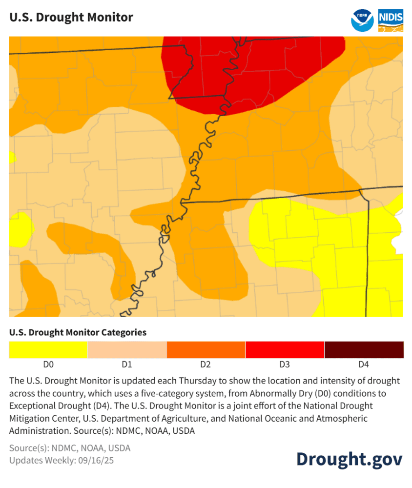
The last 10 days have featured above average temperatures with no rain to help the cause. With little rain in the few weeks (actually, couple of months!), drought conditions have only gotten worse across the Mid-South. Currently, most of the metro is under a Severe Drought (D2), with Extreme Drought (D3) conditions entering the picture over the Missouri Bootheel. Something to monitor over the next few weeks.
Weekend weather & football forecast
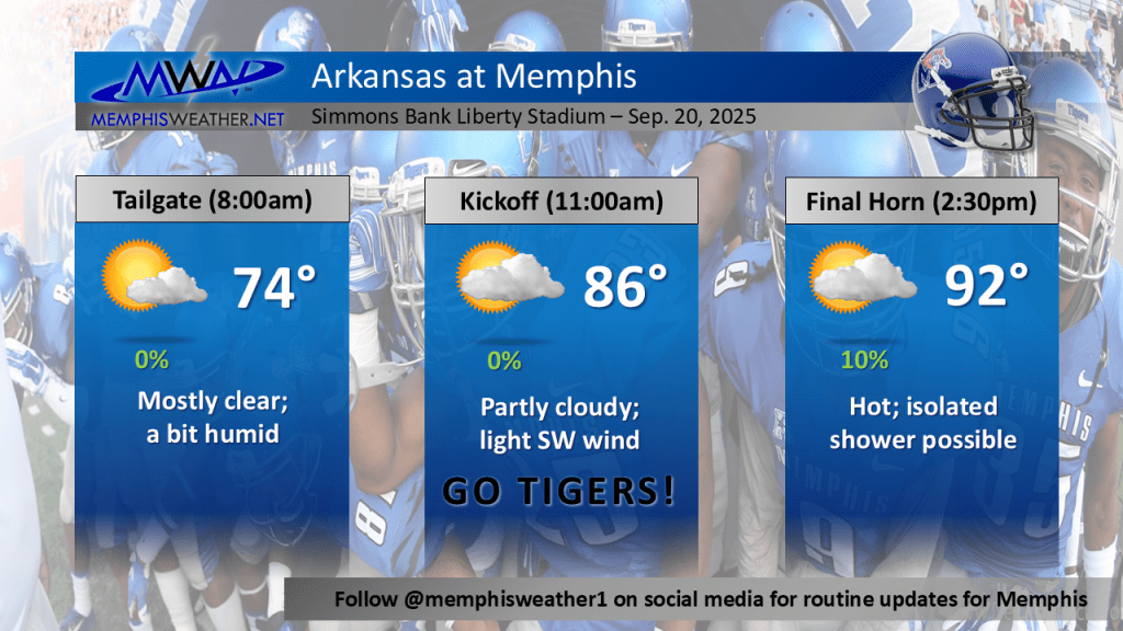
Moving forward into the weekend, the 3-0 Memphis Tigers will take on the 2-1 Arkansas Razorbacks at Simmons Bank Liberty Stadium. Kickoff is at 11am Saturday. The weather going into the weekend will feature more of this stubborn above average heat with dry conditions including for the big game tomorrow. An isolated PM shower or storm cannot be ruled out this weekend. Tailgating will feature mostly clear skies and mid-70s temps. Temperatures rise into the mid-80s for kickoff and then the lower 90s once the game finishes. It is important to stay hydrated while out enjoying the game
Autumnal equinox is followed by a weather pattern change
The Autumnal Equinox is upon us and will occur on Monday, September 22, at 1:19pm, officially ushering in fall. This means that we will roughly have the same amount of daylight and darkness on that date. It is a sign of changing seasons ahead soon, and a break from this relentless heat.
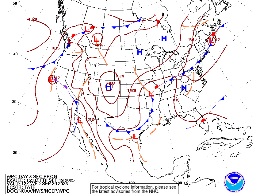
Speaking of a break from the heat, we have a much-needed weather pattern change next week. A low pressure system is likely to set up close to the Mid-South region by mid-week. From a model perspective, the American (GFS) and European model ensembles have been battling over the position of this low pressure for the last few days with decidedly different outcomes.
The GFS has it positioned much further north, closer to the St. Louis area and moving to the east slightly faster. This would bring lower chances of accumulating rain but an overall temperature drop.
The European has the low positioned slightly farther south, with a track across the Missouri Bootheel region at a slower pace. This would bring higher chances for accumulating rain and a greater overall temperature drop.
Overall, both the GFS and European forecast the idea of cooler temperatures and higher chances of rainfall, especially throughout the mid-week period. Any rain and cooler temperatures will help with this bothersome heat and dry weather! Expect highs in the 80s to return as rain chances increase next week.
Aidan O’Brien
MWN Intern
Erik Proseus
MWN Meteorologist
—
Follow MWN on Facebook, Twitter/X, BlueSky, Threads and Instagram for the routine updates every day!
Visit MemphisWeather.net for the latest weather information and our MWN Forecast for Memphis and the Mid-South
Looking for a way to support us? Click here for one-time or recurring options! Thank you!







