

A strong to severe weather threat is materializing for the Mid-South this weekend, right in the midst of lots of outdoor fall activities that tend to be focused outdoors. I wanted to give you some idea of what to expect this weekend, but particularly Saturday evening when a significant fall front arrives.
If there is any good news with the round of storms we are expecting, it will be fairly limited in duration, and it will finally kick us out of the pattern of persistent 80s as autumn takes a firm hold on our weather. The bad news is it will likely affect evening outdoor plans Saturday, could bring strong wind, and won’t bring enough rain to help our ongoing drought too much.
Weekend details
Saturday: Increasing clouds and wind. Quite warm with mild temps to start the day (upper 60s) and afternoon highs near 87, plus more noticeable humidity. South wind gusts during the afternoon will likely reach 25-30 mph and could touch 35+ mph, especially in wide open areas and near the river.
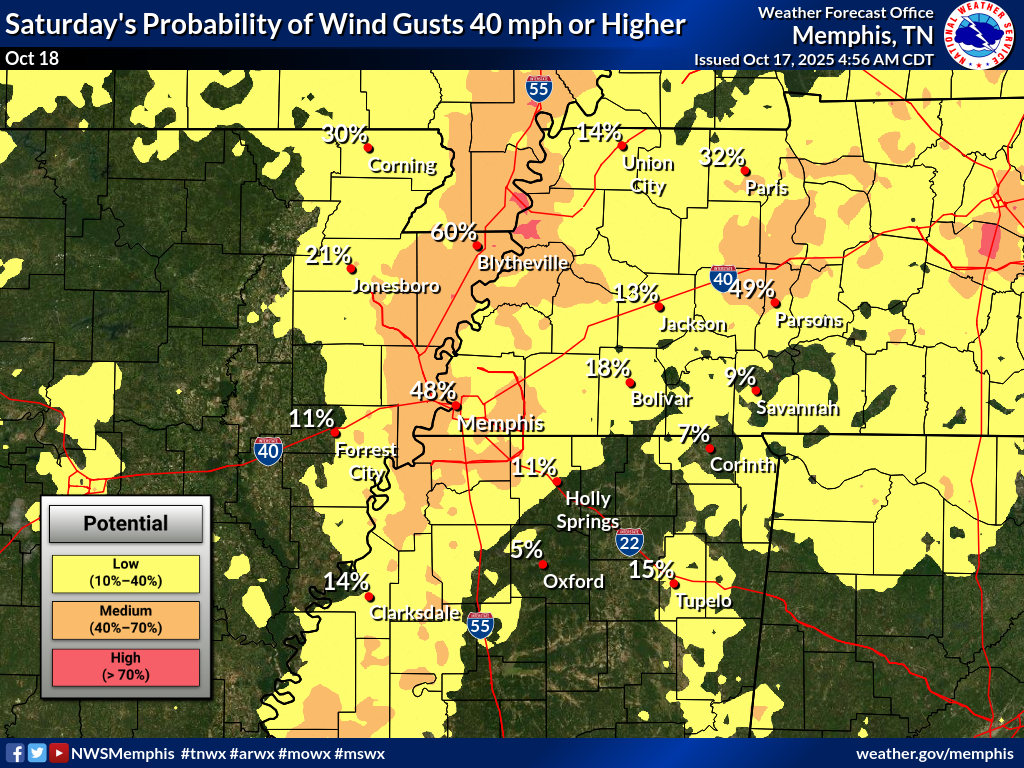
Saturday night: Level 2 severe weather risk (out of 5). A broken to solid line of storms will cross the river in the evening (targeting about 9pm, give or take an hour). Threats are a round of heavy rain, lightning, wind gust potential to 50-60 mph. The tornado threat appears low, but is not zero. Slightly better chance in AR than east of the river. Showers are likely behind the line for a couple hours, mostly ending by midnight. Total rainfall will probably be an inch or less.

Sunday: Mostly sunny, much cooler, and still breezy. Temps will be in the 60s all day with a high of 69. Northwest wind gusts again at 25-30 mph and at times could reach 35 mph before diminishing quick around sunset.
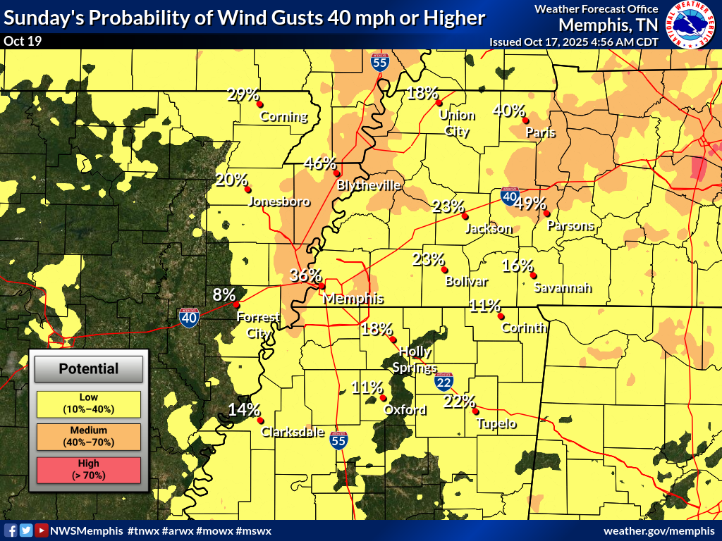
It’s been quite a while since we have talked about severe weather, but earlier this week, we published a blog about the hazards of secondary severe weather season (i.e., fall). Go ahead and secure everything outdoors, including those Halloween inflatables, or you might be gifting them to your neighbors! Plan ahead for possible power outages as well.
Behind the storms – fall weather!
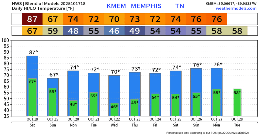
For those who have been tired of warm high pressure overhead for an exceedingly long period of time. and 80s lingering way too late into October, REAL FALL is coming with this front! Check out next week’s highs! The mid 80s tomorrow will be the last this warm for the foreseeable future. Sunday will be nearly 20 degrees cooler and very pleasant highs of 70-75 and chilly morning (40s for all of us) show up next week. (Average highs this time of year are in the mid 70s and average lows in the mid 50s.) This weather should definitely put us more in the mood for pumpkin spice and Halloween!
Erik Proseus
MWN Meteorologist
—
Follow MWN on Facebook, Twitter/X, BlueSky, Threads and Instagram for the routine updates every day!
Visit MemphisWeather.net for the latest weather information and our MWN Forecast for Memphis and the Mid-South
Looking for a way to support us? Click here for one-time or recurring options! Thank you!








Thank you