

Overview: seasonally warm to quite cold with limited precipitation chances
Above average temperatures will continue to stick around through the end of the week into the first half of the weekend. Most locations will see high temperatures around 10 degrees above average for this time of year.
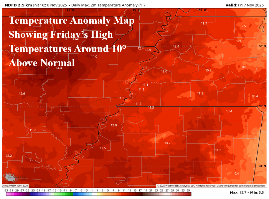
Sunny skies Thursday give way to increasing cloud cover Friday with isolated shower and thunderstorm potential for Friday afternoon. Following the above average temperatures, a significant cool down is set to begin starting Sunday. These much colder temperatures will last through the middle of next week, providing a brief taste of early winter to the area!
Fading storm chances Friday
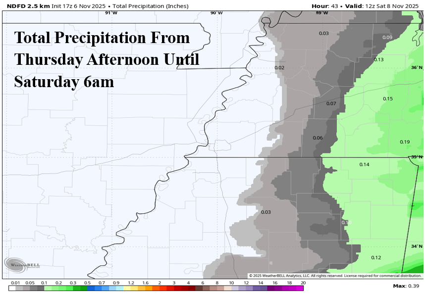
Storm and rainfall chances have continued to fizzle as Friday approaches. An upper-level trough will move through the Midwest and Great Lakes regions and will accompany a weak cold front. This front will move through the metro region on Friday evening and may bring an isolated shower.
While we thought a few days ago that there was a low end possibility of a strong storm or two in the metro, it seems more likely now that this threat will be confined to areas to our east across middle Tennessee and northeast Mississippi. Additionally, nearly all the precipitation will form east of the metro area, leaving Friday likely to remain dry.
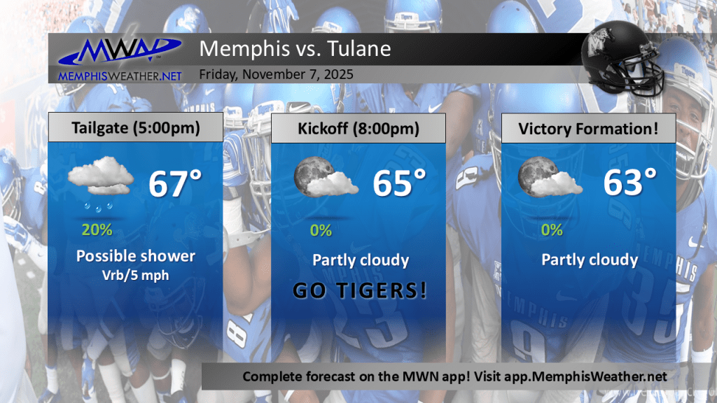
For the big game Friday, featuring the playoff-hopeful Memphis Tigers vs the Tulane Green Wave, the weather should remain mild with partly cloudy conditions. An isolated shower is possible for tailgating hours before the 8pm kickoff, but overall, it should be a great evening for football!
Significant but short-lived blast of cold air to start next week
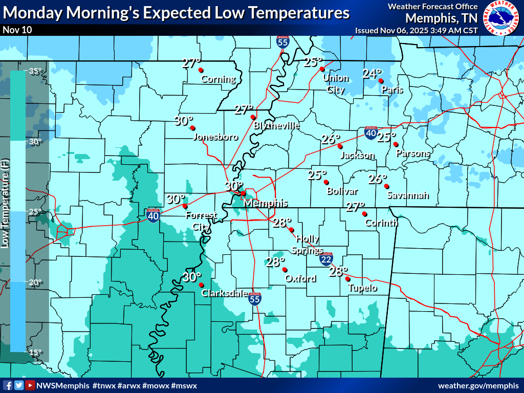
A significant cooldown to set to take place beginning Sunday and lasting through mid next week before another warm-up. Following Friday’s weak cold front, a much stronger (but likely still dry) cold front will progress through the metro on Saturday night. An arctic low originating from Northern Manitoba and the Hudson Bay regions of Canada will move southward across the Great Lakes and into the Ohio Valley. This extremely cold and dry air will lead to our first hard freeze potential this fall and may even produce some light snow across middle to eastern Tennessee underneath the low pressure.

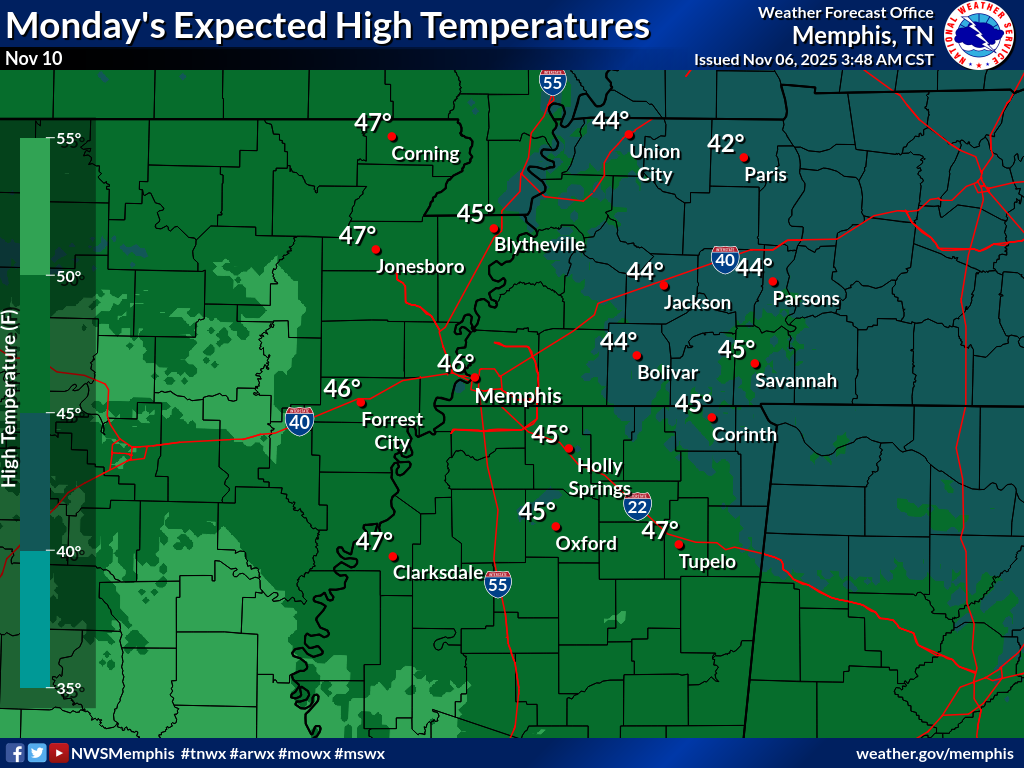
Low temperatures may dip into the upper 20s to low 30s Sunday night and Monday night so dig out that winter coat! Highs will be well below average Sunday through Veterans Day, with Mondays highs expected to only reach the mid-40s with a cold wind! Thankfully, starting Wednesday, a warmup will overcome the short-lived shot of cold air, with near average highs expected.
Aidan O’Brien
MWN Social Media Intern
—
Follow MWN on Facebook, Twitter/X, BlueSky, Threads and Instagram for the routine updates every day!
Visit MemphisWeather.net for the latest weather information and our MWN Forecast for Memphis and the Mid-South
Looking for a way to support us? Click here for one-time or recurring options! Thank you!







