

A sharp blast of Arctic air is set to move into the region later this weekend, making way for the coldest temperatures so far this season.
The Arctic air will be brought in behind a strong, but dry, cold front from Canada and will pass through Saturday night. Temperatures will fall below freezing by early Sunday morning and likely won’t return back above 32 degrees until Monday afternoon, which would result in nearly 36 hours of sub-freezing temperatures. Highs Sunday will only rise into the upper 20s, while most places in the metro drop into the teens for our lows on Monday morning.
Forecast details
As the reinforcing cold front passes through Saturday night, it will bring gusty north wind and thus very cold wind chills along with the cold temperatures. That gusty wind will make Sunday and Monday feel much colder as gusts up to 25 mph are possible Sunday morning through afternoon. Wind chills will be coldest Sunday morning – in the single digits across the region, especially north of I-40.
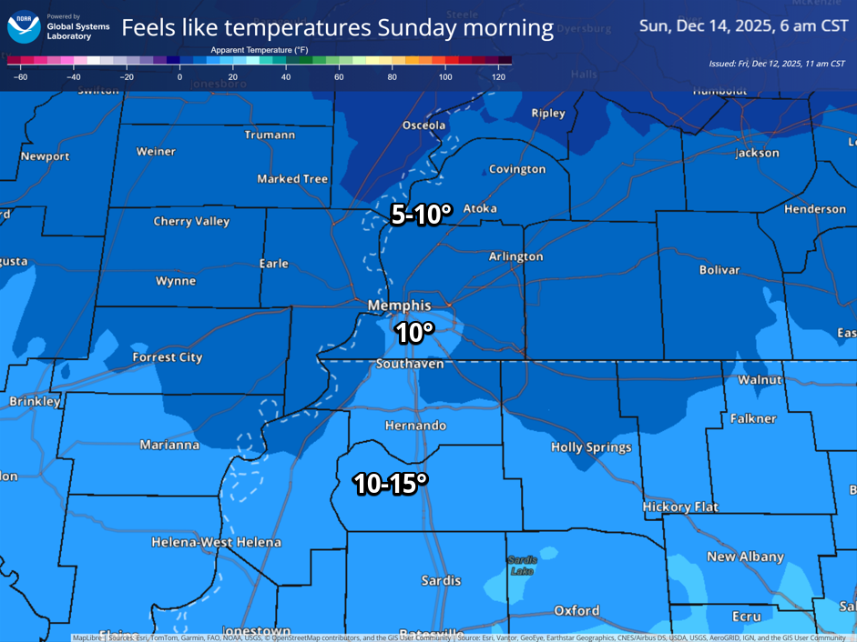
While the wind won’t be as much of a factor on Monday, it will still feel quite chilly as highs will still only be in the mid-30s after morning lows in the teens expected. Sadly for snow-lovers, sunny conditions are expected throughout this cold spell. On the bright side, road conditions won’t be an issue – at least this time!
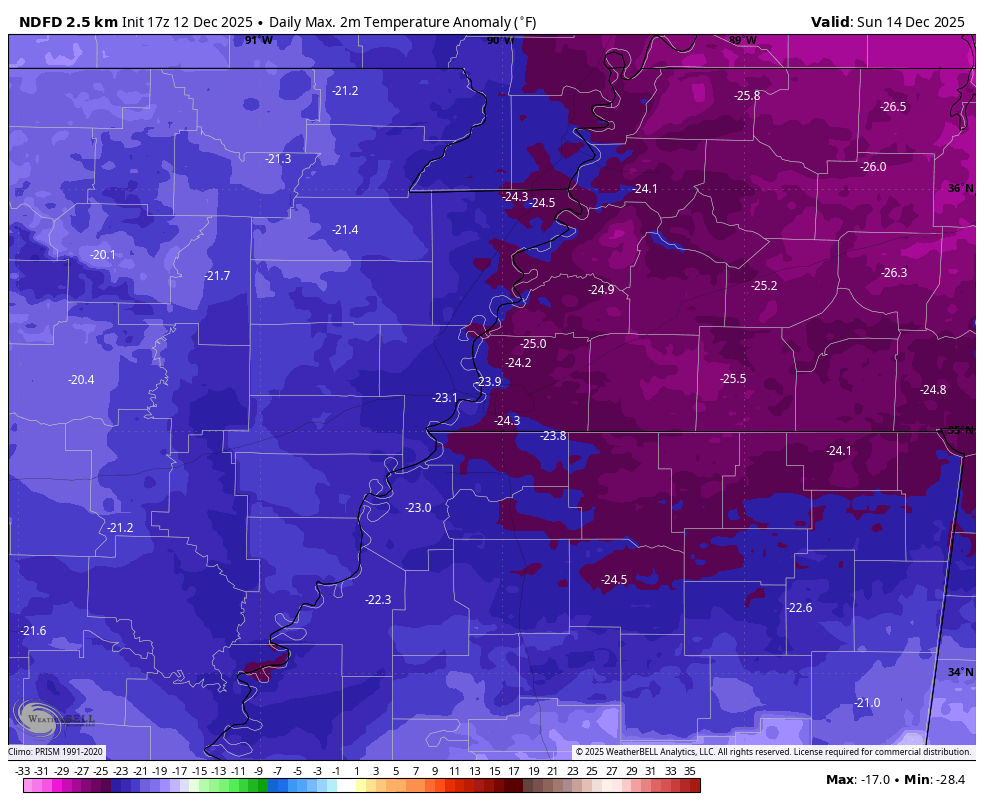
By mid-December standards, this is a notable cold spell for the region. Typical highs for this time of year are in the mid-50s, resulting in temperatures Sunday about 25 degrees below average, while Monday will be around 15 degrees below average.
As this is our first major cold spell, and with temperatures below freezing for an extended period, below is an important reminder of the “4 P’s” to properly prepare! We usually recommend that indoor sinks on exterior walls be slowly dripped when temperatures are near 20 degrees or colder, or sub-freezing conditions are expected for more than an overnight period. In addition to pipes, make sure your animals have a warm place to stay and their water bowls don’t freeze up!

Quick temperature recovery next week
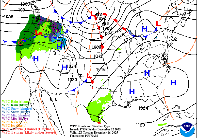
For those who aren’t fond of #StupidCold, the good news is that it will be brief. After Monday, a warming trend will quickly build across the region. By Tuesday afternoon, temperatures will begin climbing back into the upper 40’s as high pressure builds over the southeast, bringing in southerly wind. By mid-to-late week, highs will return to near or slightly above average. Sunshine is expected throughout this warming trend, helping erase the lingering chill from the Arctic air mass, however some showers may be possible into the latter parts of next week.
Aidan O’Brien
MWN Social Media Intern
—
Follow MWN on Facebook, Twitter/X, BlueSky, Threads and Instagram for the routine updates every day!
Visit MemphisWeather.net for the latest weather information and our MWN Forecast for Memphis and the Mid-South
Looking for a way to support us? Click here for one-time or recurring options! Thank you!







