

Since a picture is worth a thousand words, I thought tonight’s blog would use more graphics than text. That way I can condense thousands of words into something more consumable. We’ll start here…

This has been one of the most challenging winter forecasts I’ve had in my career. Despite the usual challenge of forecasting winter weather in the south, it’s not often that the various inputs to the forecast process are SO different 48 hours before the onset of precipitation. There are many variables that factor into this forecast, including contributing weather systems that are still more than 1000 miles away. But by the end of this blog, I hope to provide a semi-coherent idea of what we can expect!
In the past 24 hours or so, there has been a notable shift in the model data, pushing warmer air aloft closer to I-40 that was expected to stay south of the metro. The result is that a mostly-snow forecast has now added the likelihood of some sleet and freezing rain to the mix locally.
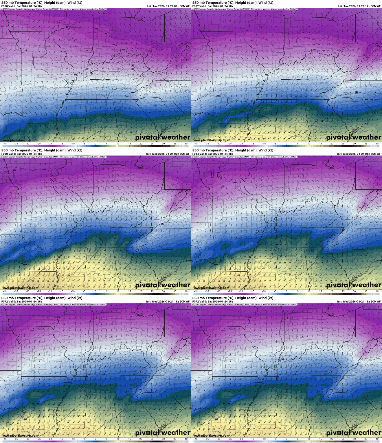
That is demonstrated above by the last 6 runs of the European model. Shown are temperatures and wind at about 5,000 feet – where air above freezing (despite very cold temperatures at the ground) results in snow transitioning to freezing rain or sleet. You’ll see that the warmer temperatures (greens/yellows) shift north. That is how a snow forecast becomes something less desirable.
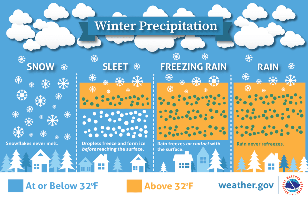
Below, you can see how the depth of warm air above the ground creates various precip types.
Moving on to how much precipitation to expect, we will look at graphics from the National Blend of Models (NBM), which that is a newer National Weather Service (NWS) product. The NBM can be particularly helpful when individual models have vastly differing opinions. It “blends” dozens of model sources together and intelligently weights them in order to provide a “smart” solution. It has its issues at times, but in this case, it could be pretty helpful to “smooth out” the vast differences.
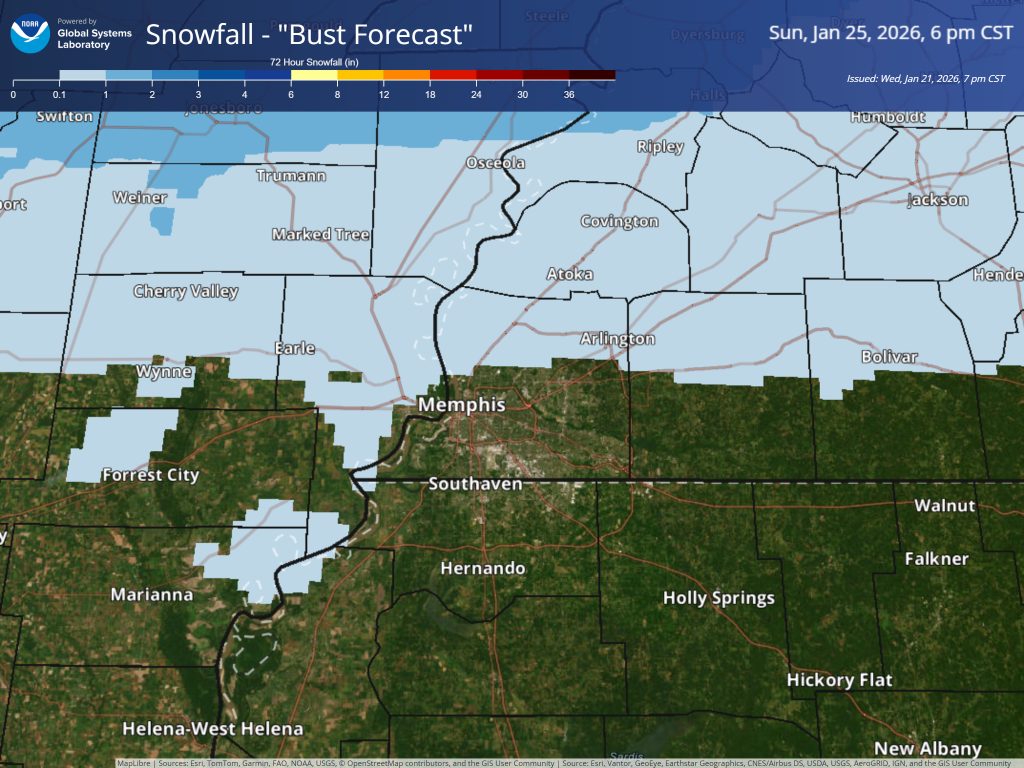

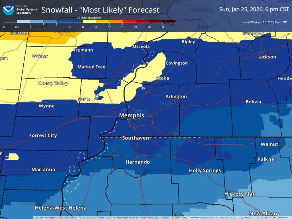
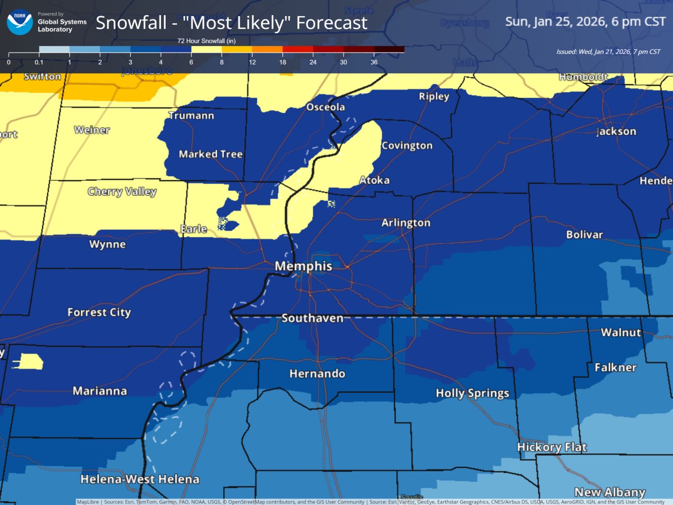
Above, the NBM “most likely” snowfall forecast, as well as the “Boom” and “Bust” potential above that. The vast range between boom and bust tells us how far apart the various model solutions are. For Memphis, it is a range of less than an inch to almost a foot! The most likely amount ends up around 4-5″ for the city – more north, less south.
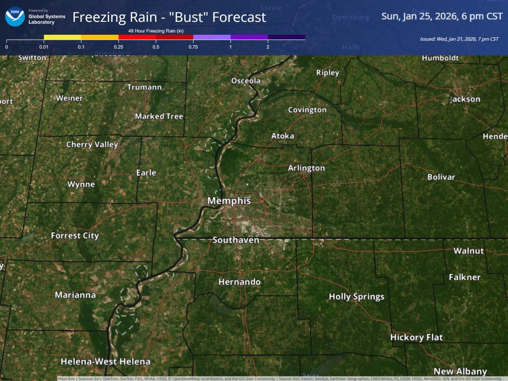

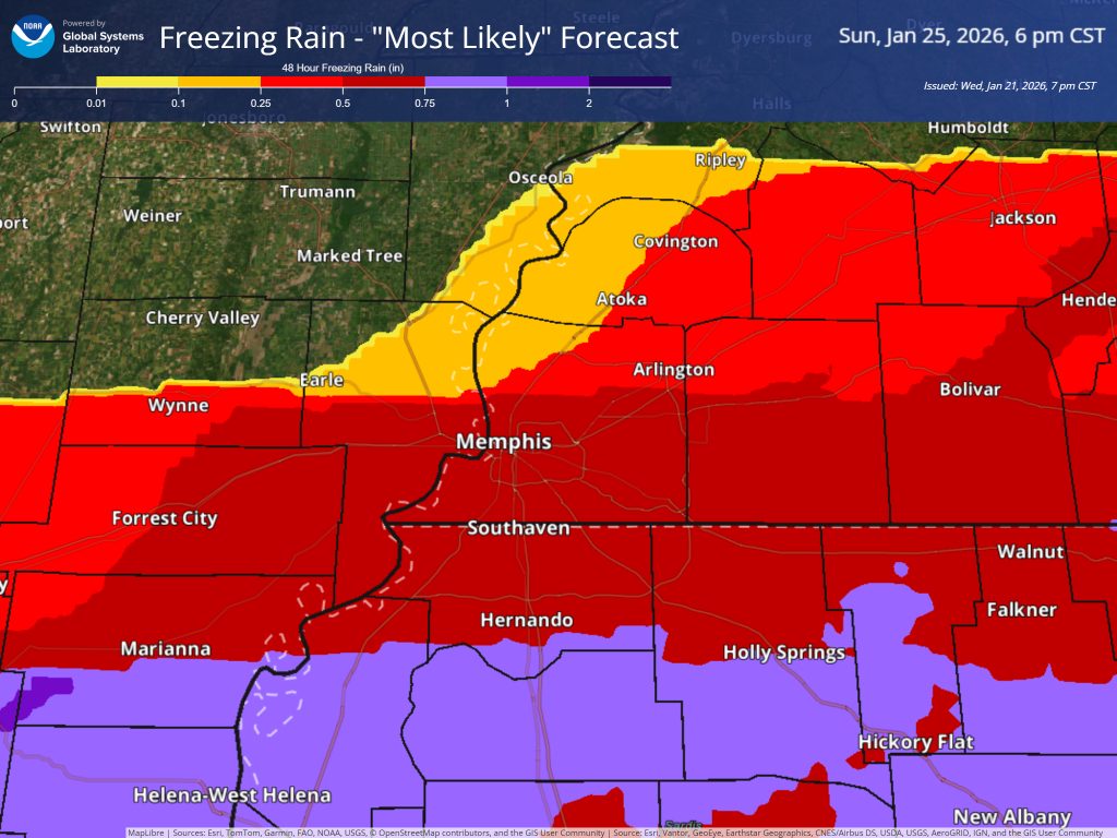
The same analysis as above is done for freezing rain in the next set of graphics. The boom and bust forecasts show a potential range of none to well over an inch of debilitating ice. Unfortunately, the most likely scenario is not a good one – almost a half inch of freezing rain in the city and as much as an inch across far north Mississippi. Totals drop off quickly to the north.
So our first call of “how much will we get” is this:
- Snow: 4-6″ along I-40, up to 6-8″ in Tipton Co. and maybe 2-3″ to the south in Tate County
- Sleet: 1.0-1.5″ along the I-40 corridor into far north MS
- Freezing rain: 0.25-0,50″ for most of the metro, less in Tipton County and more in MS
Obviously additional shifts in the pattern could change these figures, but we’ll start there.
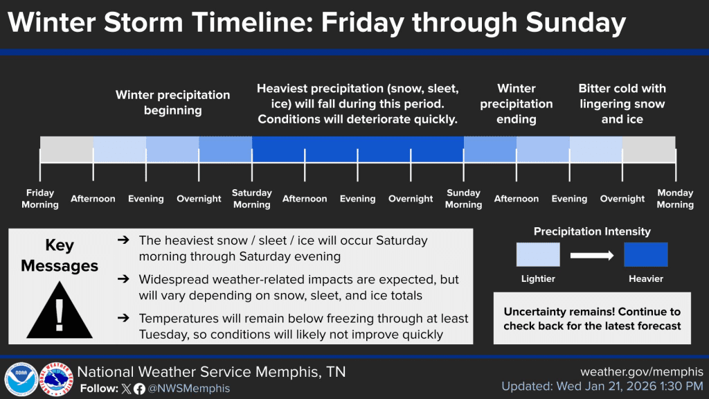
As far as how this all plays out over the 36-42 hours that precipitation is falling, the graphic below from NWS Memphis is excellent and providing a rough timeline. Locally, any precipitation that falls before late evening Friday will be very light and of the frozen variety (snow/sleet). The steadiest precipitation will occur Saturday into Saturday night, when some could be heavy. That could include freezing rain mixing with the snow and sleet (perhaps straight freezing rain in north MS). Precipitation tapers off late Saturday night and should end by midday Sunday.
Impact-wise, this storm will be significant no matter how the mixture of precip unfolds.
Freezing rain (liquid precipitation that freezes on contact with cold surfaces) is the most hazardous, especially on elevated roadways and exposed objects like power lines and tree limbs. Over a quarter inch will result in scattered power outages and downed tree branches. A half inch makes nearly all roads impassable.
Sleet is “frozen raindrops” and is slippery, but has more traction on roads. It does not stick to objects but bounces to the ground. And we all know about snow.
We highly recommend you avoid all but the most urgent and necessary travel starting Friday night. All roads could be a real challenge into Monday or Tuesday, while secondary roads may be slick longer than that due to #StupidCold air that arrives on the heels of the precip. We’re now looking at the potential for lows near zero (Fahrenheit) Monday and Tuesday mornings and not returning above freezing until Wednesday afternoon.
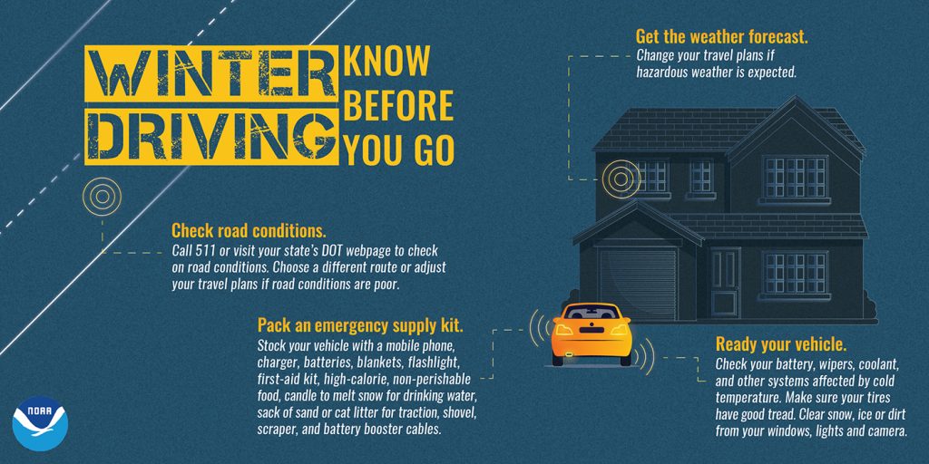
We’ve posted plenty of “preparation” graphics on social media already and will continue to do so. Below are some high level tips.

We’ll leave it at that for tonight. Please properly prepare and stay tuned to our social channels for the latest information!
Erik Proseus
MWN Meteorologist
—
Follow MWN on Facebook, Twitter/X, BlueSky, Threads and Instagram for the routine updates every day!
Visit MemphisWeather.net for the latest weather information and our MWN Forecast for Memphis and the Mid-South
Looking for a way to support us? Click here for one-time or recurring options! Thank you!








We shall see because honestly it’s not what i am feeling outside from WV lady to now a WTN woman enjoy your blessed day and weekend 🙏
Look at 1942