

Severe weather season has begun and the next round is just around the corner. We head into this round – arriving Sunday evening – with the highest severe weather risk so far this spring, And the forecast for early next week proves just how strong it is, as freezing temperatures make their way back into the Mid-South on gusty north wind. Even a few snow flurries are possible as temps drop behind the front overnight Sunday (though the chance is better to our north).
Super Saturday
Today (Saturday) is the type of spring day we all look forward to – and a really good day to prepare for tomorrow’s storm event. With temperatures in the 70s and comfortable humidity levels this Pi Day afternoon, take 3.14 minutes (or more) to secure anything outdoors that may be damaged – or go missing – in high wind. Tonight will be calm, though wind starts to increase late in the night and clouds increase.
Strong wind Sunday
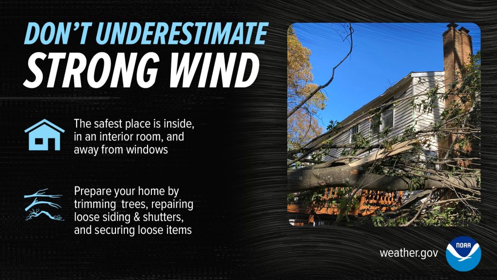
On Sunday, general wind flow increases and becomes very gusty throughout the day, with peak gusts in the 35-45 mph range as clouds thicken. The strength of the approaching system can be measured in one way by the amount of wind it produces outside of storms, and this one is potent. The morning and most of the afternoon hours will be dry as temperatures climb into the upper 70s and humidity increases.
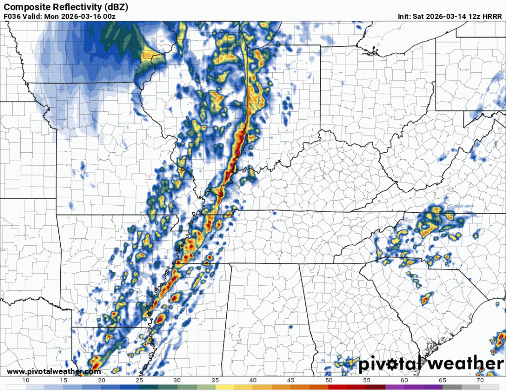
By mid to late afternoon, a line of storms will be developing to our west just ahead of the cold front. Buoyed by strong dynamics from this system and daytime heating, storms will quickly become strong to severe in a squall line as they race east towards the metro. A fully mature squall line will pass swiftly through the metro, likely between 5-9pm. Most high-res models, which now have the event in range, expect the line to cross the Mississippi River about 6-7pm. It should be out of the greater metro by 9pm.
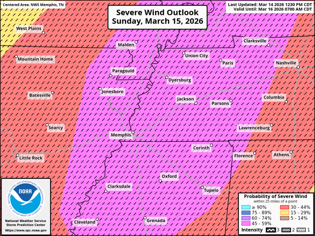
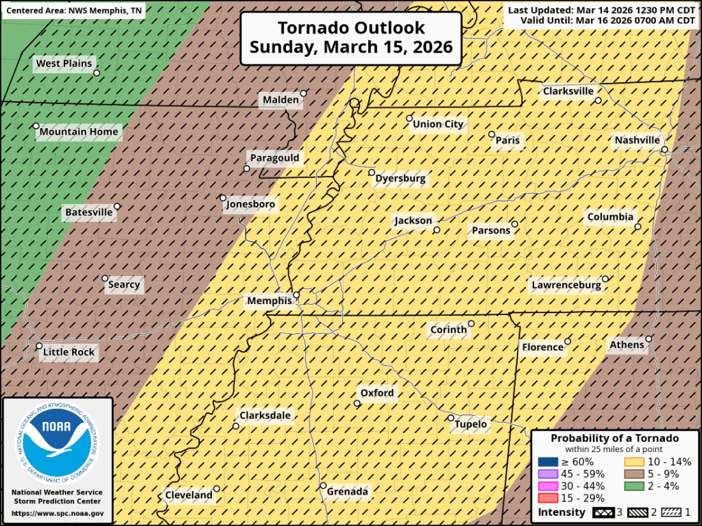
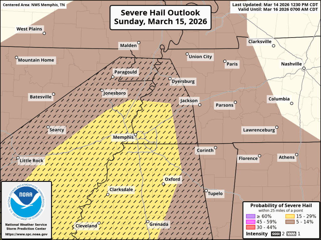
As far as threats are concerned, the greatest is possibly widespread strong wind (over 60 mph) with the potential for some gusts to exceed 75 mph. There is also enough “spin” in the atmosphere to support tornadoes. Within a squall line, tornado threats typically are limited to “spin-ups” within the line. These are often brief and can occur with little notice. They also tend to not be too strong. However, if any storms develop ahead of the main line, which appears to be possible, they will need to be watched closely for rotation and could spawn a stronger tornado and possibly large hail.

The graphics below show the probability of severe wind, tornadoes and hail within 25 miles of a point (roughly equivalent to within a county of you). The black hatching on the graphics show the new CIG1 (or “Intensity Level” 1) indicator. This tells us that there is potential for “significant” wind, tornadoes or hail (equivalent to 75 mph straight line wind, EF2 tornadoes, and 2″ hail). More on the new Intensity Levels can be found in this blog post.
Behind the storms – freezing temps and cold wind
Once storms are gone, strong cold air advection (or movement of air) pushes into the Mid-South on gusty north wind, leading to very cold temperatures compared to what we’ve experienced the past couple of weeks. Monday morning’s low will be near 32° with wind chills around 20° as gusty northwest wind to 30 mph continues. Highs Monday will only be near 40° with that cold wind continuing, A hard freeze is expected Monday night as wind lightens up, leading to low temperatures in the low to mid 20s Tuesday morning. If you have sensitive plants, you’ll want to cover them or move them indoors! Freeze Watches have been issued.
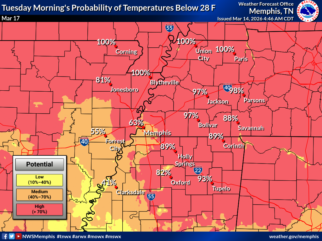
Tuesday’s high remains well below average in the mid 40s. The remainder of next week’s forecast features warming temperatures and dry, calm weather. We’ll be back in the 70s by Thursday afternoon.
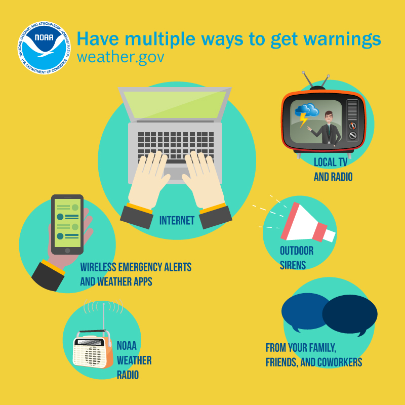
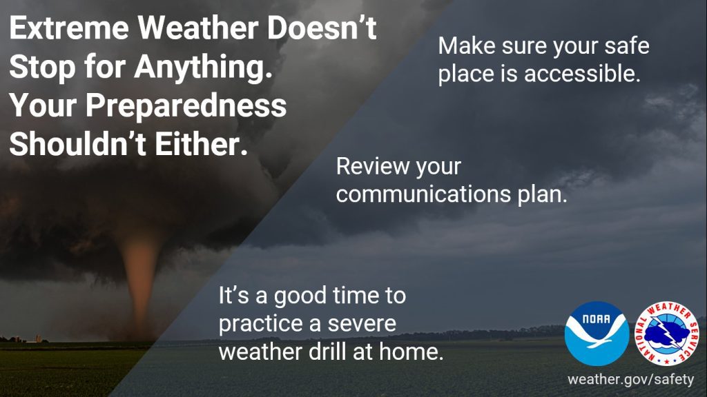
Mid-Southerners should prepare for the potential for some downed trees or limbs and power outages Sunday evening, You should also have your safe place cleaned out and ready in case a Tornado Warning is issued with little notice. You should also have multiple ways of receiving weather warnings. Of course we recommend one of them be our own, in-house severe weather alert app, StormWatch+ which will wake you up at night for the most severe storms and allows you to program up to 5 locations nationwide for 24×7 monitoring.
We’re just at the beginning of severe weather season, so it’s time to make sure you and your family are prepared for volatile spring weather ahead.
Erik Proseus
MWN Meteorologist
—
Follow MWN on Facebook, Twitter/X, BlueSky, Threads and Instagram for the routine updates every day!
Visit MemphisWeather.net for the latest weather information and our MWN Forecast for Memphis and the Mid-South
Looking for a way to support us? Click here for one-time or recurring options! Thank you!







